Fagatogo geodata
Fagatogo (Eastern District) is a populated place; located in American Samoa in Pacific/Pago_Pago (GMT-11) time zone. With population of 1,868 people, there are 6 cities with bigger population in this country. Compared to other cities in American Samoa, 59.1% of cities are located further ↓South; 63.6% of cities are located further ←West and 90.9% of cities have lower elevation than Fagatogo. Note1


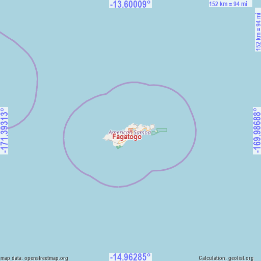
Fagatogo GPS coordinates[2]
14° 16' 57" South, 170° 41' 24" West
| Map corner | latitude | longitude |
|---|---|---|
| Upper-left | -13.60009°, | -171.39313° |
| Center: | -14.2825°, | -170.69° |
| Lower-right: | -14.96285°, | -169.98688° |
| Map W x H: | 151.5×151.5 km | = 94.1×94.1mi |
| max Lat: | -11.05528° ⇑40.9% North |
| Fagatogo: | -14.2825° |
| min Lat: | ⇓59.1% South -14.36111° |
| min Long | Fagatogo | max Long |
| -171.08833° | -170.69° | -169.51278° |
| W 63.6%⇐ | ⇒36.4% E |
Elevation
Elevation of Fagatogo is 141 m = 463 ft, and this is 80.7 m = 265 ft above average elevation for this country.
| Max E: |
363 m = 1191 ft | 9.1% |
| Fagatogo | 141 m 463 ft | |
| Avg. | 60.3 m = 198 ft | |
Min E: |
5 m = 16 ft | 90.9% |
See also: American Samoa elevation on elevation.city.
Geographical zone
Fagatogo is located in South Torrid zone (between Equator and Tropic of Capricorn). Distance of this Southern Tropic circle is 1017.9 km =632.5 mi to South.| Distance of | km | miles | from Fagatogo |
|---|---|---|---|
| Equator | 1588.1 | 986.8 | to North |
| Tropic Capricorn | 1017.9 | 632.5 | to South |
| Antarctic Circle | 5813.1 | 3612.1 | to South |
| South Pole | 8419 | 5231.3 | to South |


Nearby cities:
15 places around Fagatogo: (largest is in red/bold)
• Aoloau
9.6 km =6 mi,  244°
244°
• Aūa
2.9 km =1.8 mi,  75°
75°
• Faleniu
8.1 km =5 mi,  226°
226°
• Leloaloa
1.7 km =1.1 mi,  48°
48°
• Leone
12.3 km =7.6 mi, 236°
• Malaeimi
6.5 km =4 mi, 226°
• Malaeloa/Aitulagi
10.5 km =6.5 mi, 233°
• Malaeloa/Ituau
11 km =6.8 mi, 229°
• Mapusagafou
8.6 km =5.3 mi, 231°
• Mesepa
8 km =5 mi, 227°
• Pago Pago
1.4 km =0.9 mi,  290°
290°
• Tāfuna
6.8 km =4.2 mi,  208°
208°
• Utulei
0.9 km =0.6 mi,  123°
123°
• Vaitogi
9.8 km =6.1 mi, 209°
• Āfono
4.7 km =2.9 mi,  64°
64°
Sources, notices
• [Note1] Compared only with cities in American Samoa existing in our database
• [Src1] Map data: © OpenStreetMap contributors (CC-BY-SA)
• [Src2] Other city data from geonames.org with taken over terms of usage.
• [Src3] Geographical zone / Annual Mean Temperature by Robert A. Rohde @ Wikipedia
