Zeutschach geodata
Zeutschach (Styria) is a seat of a third-order administrative division; located in Austria in Europe/Vienna (GMT+2) time zone. With population of 213 people, there are 2840 cities with bigger population in this country. Compared to other cities in Austria, 81.3% of cities are located further ↑North; 56.3% of cities are located further →East and 95.4% of cities have lower elevation than Zeutschach. Note1
Administrative division(s):
- Level 1: Styria
- Level 2: Politischer Bezirk Murau
- Level 3: Neumarkt in der Steiermark


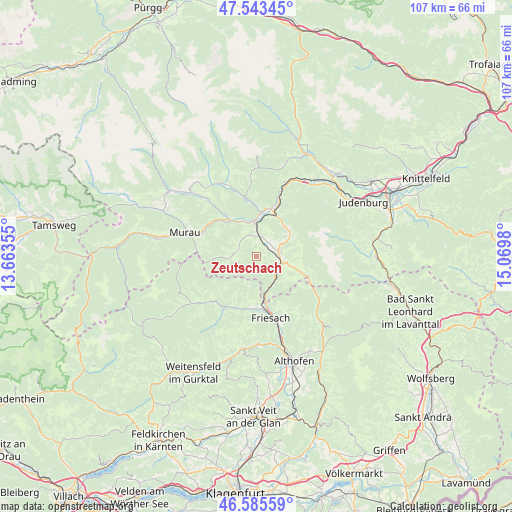
Zeutschach GPS coordinates[2]
47° 4' 0.012" North, 14° 22' 0.012" East
| Map corner | latitude | longitude |
|---|---|---|
| Upper-left | 47.54345°, | 13.66355° |
| Center: | 47.06667°, | 14.36667° |
| Lower-right: | 46.58559°, | 15.0698° |
| Map W x H: | 106.5×106.5 km | = 66.2×66.2mi |
| max Lat: | 48.98333° ⇑81.3% North |
| Zeutschach: | 47.06667° |
| min Lat: | ⇓18.7% South 46.48841° |
| min Long | Zeutschach | max Long |
| 9.57802° | 14.36667° | 17.1° |
| W 43.7%⇐ | ⇒56.3% E |
Elevation
Elevation of Zeutschach is 1038 m = 3406 ft, and this is 532.5 m = 1747 ft above average elevation for this country.
| Max E: |
2140 m = 7021 ft | 4.6% |
| Zeutschach | 1038 m 3406 ft | |
| Avg. | 505.5 m = 1658 ft | |
Min E: |
118 m = 387 ft | 95.4% |
See also: Austria elevation on elevation.city.
Geographical zone
Zeutschach is located in North temperate zone (between Tropic of Cancer and the Arctic Circle). Distance of this North polar circle is 2167.9 km =1347.1 mi to North.| Distance of | km | miles | from Zeutschach |
|---|---|---|---|
| North Pole | 4773.7 | 2966.2 | to North |
| Arctic Circle | 2167.9 | 1347.1 | to North |
| Tropic Cancer | 2627.4 | 1632.6 | to South |
| Equator | 5233.3 | 3251.8 | to South |


Nearby cities:
15 places around Zeutschach: (largest is in red/bold)
• Dürnstein in der Steiermark
8.9 km =5.5 mi,  167°
167°
• Frojach
8.4 km =5.2 mi,  328°
328°
• Kulm am Zirbitz
9.2 km =5.7 mi,  95°
95°
• Lind bei Scheifling
10.5 km =6.5 mi,  15°
15°
• Mariahof
4.5 km =2.8 mi,  34°
34°
• Neumarkt in Steiermark
4.7 km =2.9 mi,  79°
79°
• Niederwölz
9.4 km =5.8 mi,  3°
3°
• Perchau am Sattel
7.3 km =4.5 mi,  59°
59°
• Sankt Blasen
5.4 km =3.4 mi,  290°
290°
• Sankt Georgen bei Neumarkt
5.8 km =3.6 mi,  90°
90°
• Sankt Lambrecht
5 km =3.1 mi,  270°
270°
• Sankt Lorenzen bei Scheifling
9.3 km =5.8 mi, 18°
• Sankt Marein bei Neumarkt
4.7 km =2.9 mi, 91°
• Scheifling
9.9 km =6.2 mi, 20°
• Teufenbach
6.9 km =4.3 mi,  355°
355°
Sources, notices
• [Note1] Compared only with cities in Austria existing in our database
• [Src1] Map data: © OpenStreetMap contributors (CC-BY-SA)
• [Src2] Other city data from geonames.org with taken over terms of usage.
• [Src3] Geographical zone / Annual Mean Temperature by Robert A. Rohde @ Wikipedia
