Jakling geodata
Jakling (Carinthia) is a populated place; located in Austria in Europe/Vienna (GMT+1) time zone. With population of 750 people, there are 1723 cities with bigger population in this country. Compared to other cities in Austria, 93% of cities are located further ↑North; 52.4% of cities are located further ←West and 56.6% of cities have higher elevation than Jakling. Note1
Administrative division(s):
- Level 1: Carinthia
- Level 2: Politischer Bezirk Wolfsberg
- Level 3: St. Andrä


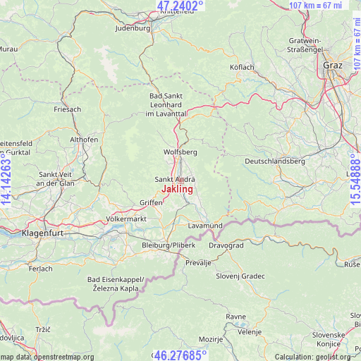
Jakling GPS coordinates[2]
46° 45' 38.448" North, 14° 50' 44.7" East
| Map corner | latitude | longitude |
|---|---|---|
| Upper-left | 47.2402°, | 14.14263° |
| Center: | 46.76068°, | 14.84575° |
| Lower-right: | 46.27685°, | 15.54888° |
| Map W x H: | 107.1×107.1 km | = 66.5×66.5mi |
| max Lat: | 48.98333° ⇑93% North |
| Jakling: | 46.76068° |
| min Lat: | ⇓7% South 46.48841° |
| min Long | Jakling | max Long |
| 9.57802° | 14.84575° | 17.1° |
| W 52.4%⇐ | ⇒47.6% E |
Elevation
Elevation of Jakling is 408 m = 1339 ft, and this is 97.5 m = 320 ft below average elevation for this country.
| Max E: |
2140 m = 7021 ft | 56.6% |
| Avg. | 505.5 m = 1658 ft | |
| Jakling | 408 m = 1339 ft | |
Min E: |
118 m = 387 ft | 43.4% |
See also: Austria elevation on elevation.city.
Geographical zone
Jakling is located in North temperate zone (between Tropic of Cancer and the Arctic Circle). Distance of this North polar circle is 2201.9 km =1368.2 mi to North.| Distance of | km | miles | from Jakling |
|---|---|---|---|
| North Pole | 4807.8 | 2987.4 | to North |
| Arctic Circle | 2201.9 | 1368.2 | to North |
| Tropic Cancer | 2593.4 | 1611.5 | to South |
| Equator | 5199.3 | 3230.7 | to South |


Nearby cities:
15 places around Jakling: (largest is in red/bold)
• Eitweg
2.9 km =1.8 mi,  76°
76°
• Gemmersdorf
5.5 km =3.4 mi,  102°
102°
• Gries
7.9 km =4.9 mi,  2°
2°
• Kleinedling
6.1 km =3.8 mi,  347°
347°
• Priel
7.5 km =4.7 mi, 352°
• Reding
6.2 km =3.9 mi, 2°
• Sankt Andrä
2.1 km =1.3 mi,  293°
293°
• Sankt Georgen
7.1 km =4.4 mi,  130°
130°
• Sankt Jakob
8.1 km =5 mi, 353°
• Sankt Johann
6.4 km =4 mi,  14°
14°
• Sankt Michael
8.9 km =5.5 mi,  337°
337°
• Sankt Paul im Levanttal
7.1 km =4.4 mi,  161°
161°
• Sankt Stefan
5.2 km =3.2 mi, 4°
• Schleifen
8.3 km =5.2 mi, 351°
• Wolfsberg
8.9 km =5.5 mi,  359°
359°
Sources, notices
• [Note1] Compared only with cities in Austria existing in our database
• [Src1] Map data: © OpenStreetMap contributors (CC-BY-SA)
• [Src2] Other city data from geonames.org with taken over terms of usage.
• [Src3] Geographical zone / Annual Mean Temperature by Robert A. Rohde @ Wikipedia
