Schleben geodata
Schleben (Carinthia) is a seat of a third-order administrative division; located in Austria in Europe/Vienna (GMT+2) time zone. With population of 27 people, there are 2947 cities with bigger population in this country. Compared to other cities in Austria, 97.7% of cities are located further ↑North; 66.4% of cities are located further →East and 66.2% of cities have lower elevation than Schleben. Note1
Administrative division(s):
- Level 1: Carinthia
- Level 2: Politischer Bezirk Villach Land
- Level 3: Wernberg


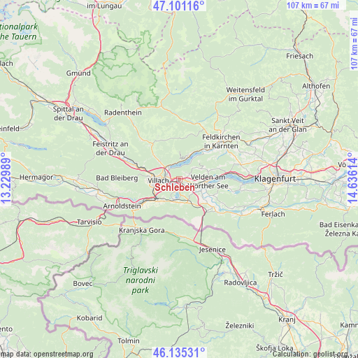
Schleben GPS coordinates[2]
46° 37' 13.404" North, 13° 55' 58.836" East
| Map corner | latitude | longitude |
|---|---|---|
| Upper-left | 47.10116°, | 13.22989° |
| Center: | 46.62039°, | 13.93301° |
| Lower-right: | 46.13531°, | 14.63614° |
| Map W x H: | 107.4×107.4 km | = 66.7×66.7mi |
| max Lat: | 48.98333° ⇑97.7% North |
| Schleben: | 46.62039° |
| min Lat: | ⇓2.3% South 46.48841° |
| min Long | Schleben | max Long |
| 9.57802° | 13.93301° | 17.1° |
| W 33.6%⇐ | ⇒66.4% E |
Elevation
Elevation of Schleben is 560 m = 1837 ft, and this is 54.5 m = 179 ft above average elevation for this country.
| Max E: |
2140 m = 7021 ft | 33.8% |
| Schleben | 560 m 1837 ft | |
| Avg. | 505.5 m = 1658 ft | |
Min E: |
118 m = 387 ft | 66.2% |
See also: Austria elevation on elevation.city.
Geographical zone
Schleben is located in North temperate zone (between Tropic of Cancer and the Arctic Circle). Distance of this North polar circle is 2217.5 km =1377.9 mi to North.| Distance of | km | miles | from Schleben |
|---|---|---|---|
| North Pole | 4823.4 | 2997.1 | to North |
| Arctic Circle | 2217.5 | 1377.9 | to North |
| Tropic Cancer | 2577.8 | 1601.8 | to South |
| Equator | 5183.7 | 3221 | to South |


Nearby cities:
15 places around Schleben: (largest is in red/bold)
• Annenheim
5 km =3.1 mi,  329°
329°
• Finkenstein am Faaker See
4.6 km =2.9 mi,  178°
178°
• Föderlach I
3.1 km =1.9 mi,  136°
136°
• Kaltschach
1.4 km =0.9 mi,  107°
107°
• Landskron
3.8 km =2.4 mi,  263°
263°
• Lind ob Velden
5.7 km =3.5 mi, 110°
• Maria Gail
5.1 km =3.2 mi,  231°
231°
• Sankt Andrä
4.1 km =2.5 mi,  310°
310°
• Sankt Leonhard
5.7 km =3.5 mi,  275°
275°
• Sankt Magdalen
3.8 km =2.4 mi, 263°
• Sankt Ulrich
1.8 km =1.1 mi,  224°
224°
• Seebach
5.1 km =3.2 mi,  265°
265°
• Villach
6 km =3.7 mi, 259°
• Wernberg
0.4 km =0.2 mi, 176°
• Wudmath
4.5 km =2.8 mi,  126°
126°
Sources, notices
• [Note1] Compared only with cities in Austria existing in our database
• [Src1] Map data: © OpenStreetMap contributors (CC-BY-SA)
• [Src2] Other city data from geonames.org with taken over terms of usage.
• [Src3] Geographical zone / Annual Mean Temperature by Robert A. Rohde @ Wikipedia
