Rathmines geodata
Rathmines (New South Wales) is a section of populated place; located in Australia in Australia/Sydney (GMT+11) time zone. With population of 1,836 people, there are 3016 cities with bigger population in this country. Compared to other cities in Australia, 57.1% of cities are located further ↓South; 78.8% of cities are located further ←West and 73.6% of cities have higher elevation than Rathmines. Note1


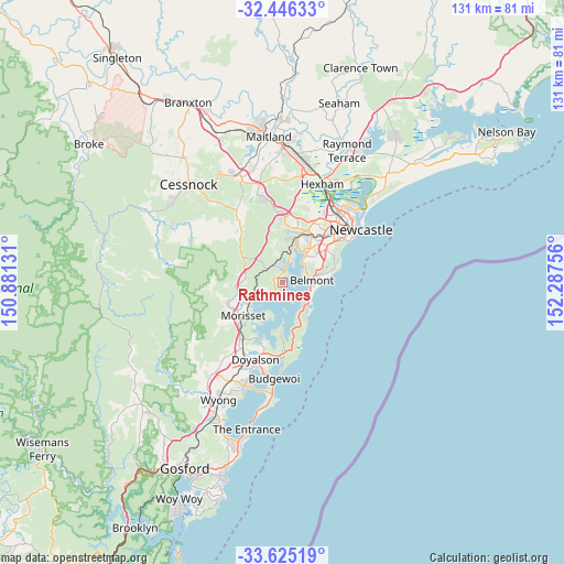
Rathmines GPS coordinates[2]
33° 2' 15.828" South, 151° 35' 3.948" East
| Map corner | latitude | longitude |
|---|---|---|
| Upper-left | -32.44633°, | 150.88131° |
| Center: | -33.03773°, | 151.58443° |
| Lower-right: | -33.62519°, | 152.28756° |
| Map W x H: | 131.1×131.1 km | = 81.5×81.5mi |
| max Lat: | -10.58257° ⇑42.9% North |
| Rathmines: | -33.03773° |
| min Lat: | ⇓57.1% South -43.31423° |
| min Long | Rathmines | max Long |
| 113.53327° | 151.58443° | 153.61246° |
| W 78.8%⇐ | ⇒21.2% E |
Elevation
Elevation of Rathmines is 20 m = 66 ft, and this is 102 m = 335 ft below average elevation for this country.
| Max E: |
1715 m = 5627 ft | 73.6% |
| Avg. | 122 m = 400 ft | |
| Rathmines | 20 m = 66 ft | |
Min E: |
-2 m = -7 ft | 26.4% |
See also: Australia elevation on elevation.city.
Geographical zone
Rathmines is located in South temperate zone (between Tropic of Capricorn and the Antarctic Circle). Distance of this Southern Tropic circle is 1067.5 km =663.3 mi to North.| Distance of | km | miles | from Rathmines |
|---|---|---|---|
| Equator | 3673.5 | 2282.6 | to North |
| Tropic Capricorn | 1067.5 | 663.3 | to North |
| Antarctic Circle | 3727.7 | 2316.3 | to South |
| South Pole | 6333.6 | 3935.5 | to South |


Nearby cities:
15 places around Rathmines: (largest is in red/bold)
• Arcadia vale
2.5 km =1.6 mi,  180°
180°
• Blackalls Park
4.3 km =2.7 mi,  354°
354°
• Bolton Point
4.7 km =2.9 mi,  30°
30°
• Buttaba
1.8 km =1.1 mi,  197°
197°
• Carey Bay
2.3 km =1.4 mi,  58°
58°
• Coal Point
2.6 km =1.6 mi,  101°
101°
• Fassifern
6 km =3.7 mi,  359°
359°
• Fennell Bay
5.3 km =3.3 mi,  16°
16°
• Fishing Point
2 km =1.2 mi,  151°
151°
• Kilaben Bay
1.7 km =1.1 mi, 24°
• Marks Point
6.4 km =4 mi,  108°
108°
• Toronto
2.8 km =1.7 mi, 17°
• Valentine
6 km =3.7 mi,  65°
65°
• Wangi Wangi
4 km =2.5 mi,  161°
161°
• Woodrising
6.1 km =3.8 mi, 19°
Sources, notices
• [Note1] Compared only with cities in Australia existing in our database
• [Src1] Map data: © OpenStreetMap contributors (CC-BY-SA)
• [Src2] Other city data from geonames.org with taken over terms of usage.
• [Src3] Geographical zone / Annual Mean Temperature by Robert A. Rohde @ Wikipedia
