Michelago geodata
Michelago (New South Wales) is a populated place; located in Australia in Australia/Sydney (GMT+11) time zone. With population of 536 people, there are 4762 cities with bigger population in this country. Compared to other cities in Australia, 77.7% of cities are located further ↑North; 55.2% of cities are located further ←West and 98.4% of cities have lower elevation than Michelago. Note1


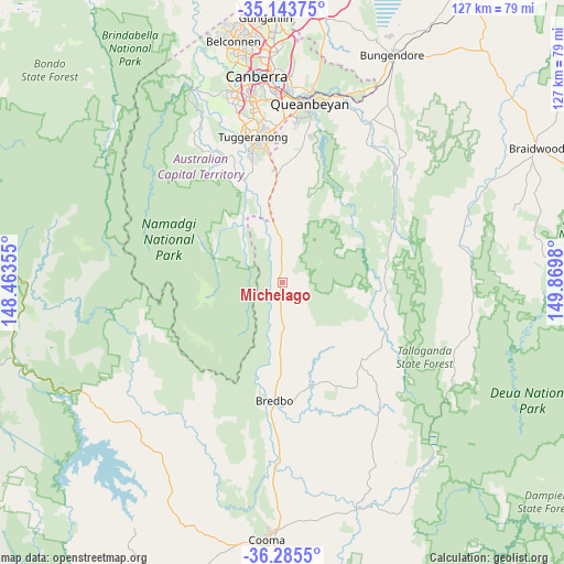
Michelago GPS coordinates[2]
35° 43' 0.012" South, 149° 10' 0.012" East
| Map corner | latitude | longitude |
|---|---|---|
| Upper-left | -35.14375°, | 148.46355° |
| Center: | -35.71667°, | 149.16667° |
| Lower-right: | -36.2855°, | 149.8698° |
| Map W x H: | 127×127 km | = 78.9×78.9mi |
| max Lat: | -10.58257° ⇑77.7% North |
| Michelago: | -35.71667° |
| min Lat: | ⇓22.3% South -43.31423° |
| min Long | Michelago | max Long |
| 113.53327° | 149.16667° | 153.61246° |
| W 55.2%⇐ | ⇒44.8% E |
Elevation
Elevation of Michelago is 699 m = 2293 ft, and this is 577 m = 1893 ft above average elevation for this country.
| Max E: |
1715 m = 5627 ft | 1.6% |
| Michelago | 699 m 2293 ft | |
| Avg. | 122 m = 400 ft | |
Min E: |
-2 m = -7 ft | 98.4% |
See also: Australia elevation on elevation.city.
Geographical zone
Michelago is located in South temperate zone (between Tropic of Capricorn and the Antarctic Circle). Distance of this Southern Tropic circle is 1365.4 km =848.4 mi to North.| Distance of | km | miles | from Michelago |
|---|---|---|---|
| Equator | 3971.3 | 2467.7 | to North |
| Tropic Capricorn | 1365.4 | 848.4 | to North |
| Antarctic Circle | 3429.9 | 2131.2 | to South |
| South Pole | 6035.7 | 3750.4 | to South |


Nearby cities:
15 places around Michelago: (largest is in red/bold)
• Banks
27.9 km =17.3 mi,  347°
347°
• Bonython
32.5 km =20.2 mi, 345°
• Burra
18.2 km =11.3 mi,  16°
16°
• Calwell
31.2 km =19.4 mi, 350°
• Captains Flat
28.8 km =17.9 mi,  60°
60°
• Chisholm
34 km =21.1 mi, 354°
• Conder
29.2 km =18.1 mi, 348°
• Gilmore
33.1 km =20.6 mi,  355°
355°
• Googong
31.2 km =19.4 mi,  7°
7°
• Gordon
29.8 km =18.5 mi, 345°
• Isabella Plains
32.8 km =20.4 mi, 347°
• Monash
34.2 km =21.3 mi, 348°
• Richardson
32.5 km =20.2 mi, 351°
• Royalla
22.3 km =13.9 mi, 356°
• Theodore
30 km =18.6 mi, 351°
Sources, notices
• [Note1] Compared only with cities in Australia existing in our database
• [Src1] Map data: © OpenStreetMap contributors (CC-BY-SA)
• [Src2] Other city data from geonames.org with taken over terms of usage.
• [Src3] Geographical zone / Annual Mean Temperature by Robert A. Rohde @ Wikipedia
