Aberglasslyn geodata
Aberglasslyn (New South Wales) is a section of populated place; located in Australia in Australia/Sydney (GMT+11) time zone. With population of 5,301 people, there are 1402 cities with bigger population in this country. Compared to other cities in Australia, 60.6% of cities are located further ↓South; 78.1% of cities are located further ←West and 59.2% of cities have higher elevation than Aberglasslyn. Note1


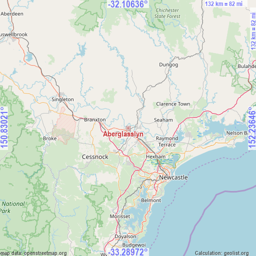
Aberglasslyn GPS coordinates[2]
32° 42' 0" South, 151° 31' 59.988" East
| Map corner | latitude | longitude |
|---|---|---|
| Upper-left | -32.10636°, | 150.83021° |
| Center: | -32.7°, | 151.53333° |
| Lower-right: | -33.28972°, | 152.23646° |
| Map W x H: | 131.6×131.6 km | = 81.8×81.8mi |
| max Lat: | -10.58257° ⇑39.4% North |
| Aberglasslyn: | -32.7° |
| min Lat: | ⇓60.6% South -43.31423° |
| min Long | Aberglasslyn | max Long |
| 113.53327° | 151.53333° | 153.61246° |
| W 78.1%⇐ | ⇒21.9% E |
Elevation
Elevation of Aberglasslyn is 33 m = 108 ft, and this is 89 m = 292 ft below average elevation for this country.
| Max E: |
1715 m = 5627 ft | 59.2% |
| Avg. | 122 m = 400 ft | |
| Aberglasslyn | 33 m = 108 ft | |
Min E: |
-2 m = -7 ft | 40.8% |
See also: Australia elevation on elevation.city.
Geographical zone
Aberglasslyn is located in South temperate zone (between Tropic of Capricorn and the Antarctic Circle). Distance of this Southern Tropic circle is 1030 km =640 mi to North.| Distance of | km | miles | from Aberglasslyn |
|---|---|---|---|
| Equator | 3635.9 | 2259.2 | to North |
| Tropic Capricorn | 1030 | 640 | to North |
| Antarctic Circle | 3765.3 | 2339.6 | to South |
| South Pole | 6371.2 | 3958.9 | to South |


Nearby cities:
15 places around Aberglasslyn: (largest is in red/bold)
• Bolwarra
3.6 km =2.2 mi,  120°
120°
• Bolwarra Heights
4.9 km =3 mi,  91°
91°
• East Maitland
7.3 km =4.5 mi,  139°
139°
• Gillieston Heights
6.9 km =4.3 mi,  183°
183°
• Largs
6.2 km =3.9 mi, 90°
• Lochinvar
7.3 km =4.5 mi,  271°
271°
• Lorn
4.7 km =2.9 mi,  129°
129°
• Louth Park
8 km =5 mi,  169°
169°
• Maitland
4.3 km =2.7 mi,  148°
148°
• Maitland city centre
4.1 km =2.5 mi, 152°
• Raworth
8.6 km =5.3 mi, 115°
• Rutherford
1.9 km =1.2 mi, 180°
• Telarah
3.2 km =2 mi, 177°
• Tenambit
8.7 km =5.4 mi, 120°
• Windella
5 km =3.1 mi, 265°
Sources, notices
• [Note1] Compared only with cities in Australia existing in our database
• [Src1] Map data: © OpenStreetMap contributors (CC-BY-SA)
• [Src2] Other city data from geonames.org with taken over terms of usage.
• [Src3] Geographical zone / Annual Mean Temperature by Robert A. Rohde @ Wikipedia
