Toowoon Bay geodata
Toowoon Bay (New South Wales) is a section of populated place; located in Australia in Australia/Sydney (GMT+11) time zone. With population of 537 people, there are 4757 cities with bigger population in this country. Compared to other cities in Australia, 54.9% of cities are located further ↓South; 77.7% of cities are located further ←West and 67.2% of cities have higher elevation than Toowoon Bay. Note1


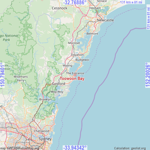
Toowoon Bay GPS coordinates[2]
33° 21' 29.232" South, 151° 29' 49.668" East
| Map corner | latitude | longitude |
|---|---|---|
| Upper-left | -32.76886°, | 150.79401° |
| Center: | -33.35812°, | 151.49713° |
| Lower-right: | -33.94342°, | 152.20026° |
| Map W x H: | 130.6×130.6 km | = 81.2×81.2mi |
| max Lat: | -10.58257° ⇑45.1% North |
| Toowoon Bay: | -33.35812° |
| min Lat: | ⇓54.9% South -43.31423° |
| min Long | Toowoon Bay | max Long |
| 113.53327° | 151.49713° | 153.61246° |
| W 77.7%⇐ | ⇒22.3% E |
Elevation
Elevation of Toowoon Bay is 25 m = 82 ft, and this is 97 m = 318 ft below average elevation for this country.
| Max E: |
1715 m = 5627 ft | 67.2% |
| Avg. | 122 m = 400 ft | |
| Toowoon Bay | 25 m = 82 ft | |
Min E: |
-2 m = -7 ft | 32.8% |
See also: Australia elevation on elevation.city.
Geographical zone
Toowoon Bay is located in South temperate zone (between Tropic of Capricorn and the Antarctic Circle). Distance of this Southern Tropic circle is 1103.2 km =685.5 mi to North.| Distance of | km | miles | from Toowoon Bay |
|---|---|---|---|
| Equator | 3709.1 | 2304.7 | to North |
| Tropic Capricorn | 1103.2 | 685.5 | to North |
| Antarctic Circle | 3692.1 | 2294.2 | to South |
| South Pole | 6298 | 3913.4 | to South |


Nearby cities:
15 places around Toowoon Bay: (largest is in red/bold)
• Bateau Bay
4 km =2.5 mi,  225°
225°
• Berkeley Vale
6 km =3.7 mi,  278°
278°
• Blue Bay
0.5 km =0.3 mi,  33°
33°
• Chittaway Bay
7.1 km =4.4 mi,  298°
298°
• Chittaway Point
6.4 km =4 mi,  306°
306°
• Forresters Beach
5.8 km =3.6 mi,  199°
199°
• Glenning Valley
6.6 km =4.1 mi,  274°
274°
• Killarney Vale
3.7 km =2.3 mi,  261°
261°
• Long Jetty
0.8 km =0.5 mi, 261°
• Shelly Beach
1.7 km =1.1 mi,  219°
219°
• Tacoma
8.4 km =5.2 mi,  337°
337°
• The Entrance
2.2 km =1.4 mi,  1°
1°
• The Entrance North
2.6 km =1.6 mi,  13°
13°
• Tumbi Vmbi
4.5 km =2.8 mi, 257°
• Wamberal
8 km =5 mi, 216°
Sources, notices
• [Note1] Compared only with cities in Australia existing in our database
• [Src1] Map data: © OpenStreetMap contributors (CC-BY-SA)
• [Src2] Other city data from geonames.org with taken over terms of usage.
• [Src3] Geographical zone / Annual Mean Temperature by Robert A. Rohde @ Wikipedia
