Tiwi geodata
Tiwi (Northern Territory) is a section of populated place; located in Australia in Australia/Darwin (GMT+9.5) time zone. With population of 2,954 people, there are 2279 cities with bigger population in this country. Compared to other cities in Australia, 99.7% of cities are located further ↓South; 88.1% of cities are located further →East and 86.8% of cities have higher elevation than Tiwi. Note1


Tiwi GPS coordinates[2]
12° 21' 31.536" South, 130° 52' 40.8" East
| Map corner | latitude | longitude |
|---|---|---|
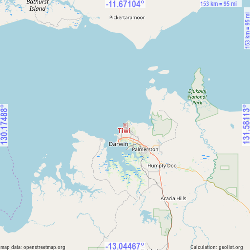
| Upper-left | -11.67104°, | 130.17488° |
| Center: | -12.35876°, | 130.878° |
| Lower-right: | -13.04467°, | 131.58113° |
| Map W x H: | 152.7×152.7 km | = 94.9×94.9mi |
| max Lat: | -10.58257° ⇑0.3% North |
| Tiwi: | -12.35876° |
| min Lat: | ⇓99.7% South -43.31423° |
| min Long | Tiwi | max Long |
| 113.53327° | 130.878° | 153.61246° |
| W 11.9%⇐ | ⇒88.1% E |
Elevation
Elevation of Tiwi is 11 m = 36 ft, and this is 111 m = 364 ft below average elevation for this country.
| Max E: |
1715 m = 5627 ft | 86.8% |
| Avg. | 122 m = 400 ft | |
| Tiwi | 11 m = 36 ft | |
Min E: |
-2 m = -7 ft | 13.2% |
See also: Australia elevation on elevation.city.
Geographical zone
Tiwi is located in South Torrid zone (between Equator and Tropic of Capricorn). Distance of this Southern Tropic circle is 1231.8 km =765.4 mi to South.| Distance of | km | miles | from Tiwi |
|---|---|---|---|
| Equator | 1374.2 | 853.9 | to North |
| Tropic Capricorn | 1231.8 | 765.4 | to South |
| Antarctic Circle | 6027 | 3745 | to South |
| South Pole | 8632.9 | 5364.2 | to South |


Nearby cities:
15 places around Tiwi: (largest is in red/bold)
• Alawa
2.4 km =1.5 mi,  192°
192°
• Anula
3.9 km =2.4 mi,  159°
159°
• Brinkin
1.7 km =1.1 mi,  219°
219°
• Jingili
3.4 km =2.1 mi, 189°
• Leanyer
2.5 km =1.6 mi,  110°
110°
• Lyons
1.1 km =0.7 mi,  92°
92°
• Millner
4 km =2.5 mi,  204°
204°
• Moil
3.3 km =2.1 mi,  174°
174°
• Muirhead
1.7 km =1.1 mi, 89°
• Nakara
1.3 km =0.8 mi,  183°
183°
• Nightcliff
3.9 km =2.4 mi,  226°
226°
• Rapid Creek
3.2 km =2 mi, 220°
• Wagaman
2.6 km =1.6 mi, 161°
• Wanguri
1.8 km =1.1 mi,  141°
141°
• Wulagi
3.3 km =2.1 mi,  145°
145°
Sources, notices
• [Note1] Compared only with cities in Australia existing in our database
• [Src1] Map data: © OpenStreetMap contributors (CC-BY-SA)
• [Src2] Other city data from geonames.org with taken over terms of usage.
• [Src3] Geographical zone / Annual Mean Temperature by Robert A. Rohde @ Wikipedia
