Leppington geodata
Leppington (New South Wales) is a section of populated place; located in Australia in Australia/Sydney (GMT+11) time zone. With population of 3,432 people, there are 2015 cities with bigger population in this country. Compared to other cities in Australia, 58.3% of cities are located further ↑North; 62.4% of cities are located further ←West and 70.6% of cities have lower elevation than Leppington. Note1


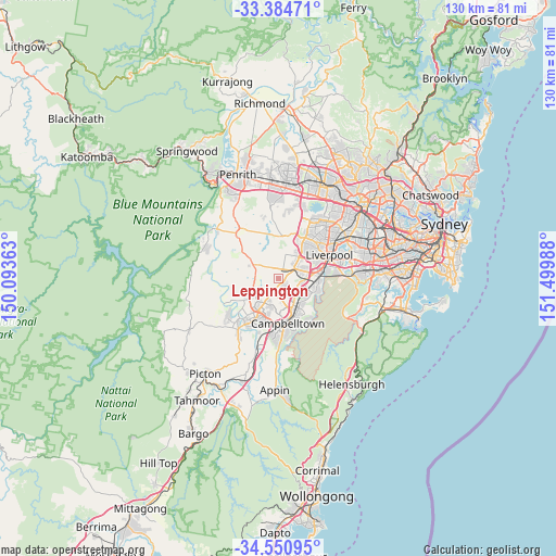
Leppington GPS coordinates[2]
33° 58' 11.388" South, 150° 47' 48.3" East
| Map corner | latitude | longitude |
|---|---|---|
| Upper-left | -33.38471°, | 150.09363° |
| Center: | -33.96983°, | 150.79675° |
| Lower-right: | -34.55095°, | 151.49988° |
| Map W x H: | 129.7×129.7 km | = 80.6×80.6mi |
| max Lat: | -10.58257° ⇑58.3% North |
| Leppington: | -33.96983° |
| min Lat: | ⇓41.7% South -43.31423° |
| min Long | Leppington | max Long |
| 113.53327° | 150.79675° | 153.61246° |
| W 62.4%⇐ | ⇒37.6% E |
Elevation
Elevation of Leppington is 106 m = 348 ft, and this is 16 m = 52 ft below average elevation for this country.
| Max E: |
1715 m = 5627 ft | 29.4% |
| Avg. | 122 m = 400 ft | |
| Leppington | 106 m = 348 ft | |
Min E: |
-2 m = -7 ft | 70.6% |
See also: Australia elevation on elevation.city.
Geographical zone
Leppington is located in South temperate zone (between Tropic of Capricorn and the Antarctic Circle). Distance of this Southern Tropic circle is 1171.2 km =727.7 mi to North.| Distance of | km | miles | from Leppington |
|---|---|---|---|
| Equator | 3777.1 | 2347 | to North |
| Tropic Capricorn | 1171.2 | 727.7 | to North |
| Antarctic Circle | 3624.1 | 2251.9 | to South |
| South Pole | 6230 | 3871.1 | to South |


Nearby cities:
15 places around Leppington: (largest is in red/bold)
• Austral
4.8 km =3 mi,  12°
12°
• Bardia
6.2 km =3.9 mi,  98°
98°
• Bow Bowing
6.6 km =4.1 mi,  142°
142°
• Carnes Hill
5.9 km =3.7 mi,  54°
54°
• Catherine Field
4.4 km =2.7 mi,  210°
210°
• Denham Court
4.8 km =3 mi,  107°
107°
• Edmondson Park
6.1 km =3.8 mi,  76°
76°
• Eschol Park
6.8 km =4.2 mi,  169°
169°
• Horningsea Park
5.4 km =3.4 mi,  56°
56°
• Hoxton Park
6.8 km =4.2 mi, 50°
• Kearns
5.8 km =3.6 mi,  176°
176°
• Oran Park
6.6 km =4.1 mi,  232°
232°
• Raby
5.7 km =3.5 mi,  160°
160°
• St Andrews
6.6 km =4.1 mi,  152°
152°
• West Hoxton
5.2 km =3.2 mi,  39°
39°
Sources, notices
• [Note1] Compared only with cities in Australia existing in our database
• [Src1] Map data: © OpenStreetMap contributors (CC-BY-SA)
• [Src2] Other city data from geonames.org with taken over terms of usage.
• [Src3] Geographical zone / Annual Mean Temperature by Robert A. Rohde @ Wikipedia
