Paralowie geodata
Paralowie (South Australia) is a section of populated place; located in Australia in Australia/Adelaide (GMT+10.5) time zone. With population of 16,386 people, there are 230 cities with bigger population in this country. Compared to other cities in Australia, 65.3% of cities are located further ↑North; 81.1% of cities are located further →East and 72.3% of cities have higher elevation than Paralowie. Note1


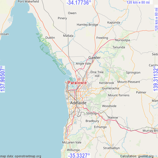
Paralowie GPS coordinates[2]
34° 45' 25.38" South, 138° 36' 29.484" East
| Map corner | latitude | longitude |
|---|---|---|
| Upper-left | -34.17736°, | 137.90507° |
| Center: | -34.75705°, | 138.60819° |
| Lower-right: | -35.3327°, | 139.31132° |
| Map W x H: | 128.5×128.5 km | = 79.8×79.8mi |
| max Lat: | -10.58257° ⇑65.3% North |
| Paralowie: | -34.75705° |
| min Lat: | ⇓34.7% South -43.31423° |
| min Long | Paralowie | max Long |
| 113.53327° | 138.60819° | 153.61246° |
| W 18.9%⇐ | ⇒81.1% E |
Elevation
Elevation of Paralowie is 21 m = 69 ft, and this is 101 m = 331 ft below average elevation for this country.
| Max E: |
1715 m = 5627 ft | 72.3% |
| Avg. | 122 m = 400 ft | |
| Paralowie | 21 m = 69 ft | |
Min E: |
-2 m = -7 ft | 27.7% |
See also: Australia elevation on elevation.city.
Geographical zone
Paralowie is located in South temperate zone (between Tropic of Capricorn and the Antarctic Circle). Distance of this Southern Tropic circle is 1258.7 km =782.1 mi to North.| Distance of | km | miles | from Paralowie |
|---|---|---|---|
| Equator | 3864.6 | 2401.4 | to North |
| Tropic Capricorn | 1258.7 | 782.1 | to North |
| Antarctic Circle | 3536.6 | 2197.5 | to South |
| South Pole | 6142.4 | 3816.7 | to South |


Nearby cities:
15 places around Paralowie: (largest is in red/bold)
• Brahma Lodge
4.6 km =2.9 mi,  117°
117°
• Burton
2.7 km =1.7 mi,  348°
348°
• Direk
4 km =2.5 mi, 351°
• Elizabeth Grove
6.1 km =3.8 mi,  66°
66°
• Elizabeth South
5.7 km =3.5 mi,  60°
60°
• Elizabeth Vale
5.6 km =3.5 mi,  80°
80°
• Parafield Gardens
2.8 km =1.7 mi,  175°
175°
• Salisbury
2.5 km =1.6 mi,  114°
114°
• Salisbury Downs
1.7 km =1.1 mi,  133°
133°
• Salisbury East
5.6 km =3.5 mi, 131°
• Salisbury Heights
6.2 km =3.9 mi,  96°
96°
• Salisbury North
1.4 km =0.9 mi,  53°
53°
• Salisbury Park
5.7 km =3.5 mi, 95°
• Salisbury Plain
5.3 km =3.3 mi, 109°
• Waterloo Corner
5 km =3.1 mi,  333°
333°
Sources, notices
• [Note1] Compared only with cities in Australia existing in our database
• [Src1] Map data: © OpenStreetMap contributors (CC-BY-SA)
• [Src2] Other city data from geonames.org with taken over terms of usage.
• [Src3] Geographical zone / Annual Mean Temperature by Robert A. Rohde @ Wikipedia
