Rosebery geodata
Rosebery (Northern Territory) is a section of populated place; located in Australia in Australia/Darwin (GMT+9.5) time zone. With population of 4,134 people, there are 1743 cities with bigger population in this country. Compared to other cities in Australia, 98.8% of cities are located further ↓South; 87.6% of cities are located further →East and 83.5% of cities have higher elevation than Rosebery. Note1


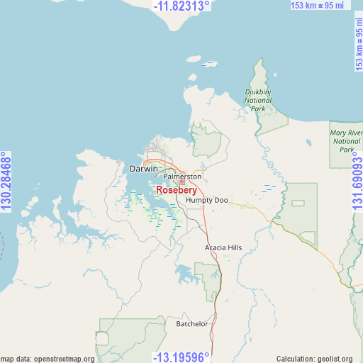
Rosebery GPS coordinates[2]
12° 30' 37.656" South, 130° 59' 16.08" East
| Map corner | latitude | longitude |
|---|---|---|
| Upper-left | -11.82313°, | 130.28468° |
| Center: | -12.51046°, | 130.9878° |
| Lower-right: | -13.19596°, | 131.69093° |
| Map W x H: | 152.6×152.6 km | = 94.8×94.8mi |
| max Lat: | -10.58257° ⇑1.2% North |
| Rosebery: | -12.51046° |
| min Lat: | ⇓98.8% South -43.31423° |
| min Long | Rosebery | max Long |
| 113.53327° | 130.9878° | 153.61246° |
| W 12.4%⇐ | ⇒87.6% E |
Elevation
Elevation of Rosebery is 13 m = 43 ft, and this is 109 m = 358 ft below average elevation for this country.
| Max E: |
1715 m = 5627 ft | 83.5% |
| Avg. | 122 m = 400 ft | |
| Rosebery | 13 m = 43 ft | |
Min E: |
-2 m = -7 ft | 16.5% |
See also: Australia elevation on elevation.city.
Geographical zone
Rosebery is located in South Torrid zone (between Equator and Tropic of Capricorn). Distance of this Southern Tropic circle is 1214.9 km =754.9 mi to South.| Distance of | km | miles | from Rosebery |
|---|---|---|---|
| Equator | 1391 | 864.3 | to North |
| Tropic Capricorn | 1214.9 | 754.9 | to South |
| Antarctic Circle | 6010.1 | 3734.5 | to South |
| South Pole | 8616 | 5353.7 | to South |


Nearby cities:
15 places around Rosebery: (largest is in red/bold)
• Bakewell
1.6 km =1 mi,  22°
22°
• Bellamack
0.9 km =0.6 mi,  212°
212°
• Coolalinga
6 km =3.7 mi,  103°
103°
• Driver
3 km =1.9 mi,  333°
333°
• Durack
4.5 km =2.8 mi,  337°
337°
• Farrar
3.5 km =2.2 mi, 18°
• Gray
2.3 km =1.4 mi, 344°
• Gunn
2.6 km =1.6 mi,  13°
13°
• Johnston
3.6 km =2.2 mi,  45°
45°
• Marlow Lagoon
3.3 km =2.1 mi,  309°
309°
• Moulden
1.7 km =1.1 mi,  288°
288°
• Palmerston
2.8 km =1.7 mi,  349°
349°
• Virginia
4.5 km =2.8 mi, 102°
• Woodroffe
1.3 km =0.8 mi,  319°
319°
• Zuccoli
2.1 km =1.3 mi,  80°
80°
Sources, notices
• [Note1] Compared only with cities in Australia existing in our database
• [Src1] Map data: © OpenStreetMap contributors (CC-BY-SA)
• [Src2] Other city data from geonames.org with taken over terms of usage.
• [Src3] Geographical zone / Annual Mean Temperature by Robert A. Rohde @ Wikipedia
