San Nicolas geodata
San Nicolas is a populated place; located in Aruba in America/Aruba (GMT-4) time zone. With population of 15,200 people, there are 2 cities with bigger population in this country. Compared to other cities in Aruba, 100% of cities are located further ↑North; 100% of cities are located further ←West and 100% of cities have higher elevation than San Nicolas. Note1


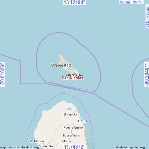
San Nicolas GPS coordinates[2]
12° 26' 10.464" North, 69° 54' 25.668" West
| Map corner | latitude | longitude |
|---|---|---|
| Upper-left | 13.12194°, | -70.61026° |
| Center: | 12.43624°, | -69.90713° |
| Lower-right: | 11.74872°, | -69.20401° |
| Map W x H: | 152.7×152.7 km | = 94.9×94.9mi |
| max Lat: | 12.53914° ⇑100% North |
| San Nicolas: | 12.43624° |
| min Lat: | ⇓0% South 12.43624° |
| min Long | San Nicolas | max Long |
| -70.02703° | -69.90713° | -69.90713° |
| W 100%⇐ | ⇒0% E |
Elevation
Elevation of San Nicolas is 13 m = 43 ft, and this is 38.7 m = 127 ft below average elevation for this country.
| Max E: |
111 m = 364 ft | 100% |
| Avg. | 51.7 m = 170 ft | |
| San Nicolas | 13 m = 43 ft | |
Min E: |
13 m = 43 ft | 0% |
See also: Aruba elevation on elevation.city.
Geographical zone
San Nicolas is located in North Torrid zone (between Equator and Tropic of Cancer). Distance of this Northern Tropic circle is 1223.1 km =760 mi to North.| Distance of | km | miles | from San Nicolas |
|---|---|---|---|
| North Pole | 8624.3 | 5358.9 | to North |
| Arctic Circle | 6018.4 | 3739.7 | to North |
| Tropic Cancer | 1223.1 | 760 | to North |
| Equator | 1382.8 | 859.2 | to South |


Nearby cities:
5 places around San Nicolas: (largest is in red/bold)
• Oranjestad
16.3 km =10.1 mi,  306°
306°
• Paradera
15.4 km =9.6 mi,  315°
315°
• Santa Cruz
11.4 km =7.1 mi, 315°
• Savaneta
3.7 km =2.3 mi,  294°
294°
• Tanki Leendert
16.8 km =10.4 mi, 313°
Sources, notices
• [Note1] Compared only with cities in Aruba existing in our database
• [Src1] Map data: © OpenStreetMap contributors (CC-BY-SA)
• [Src2] Other city data from geonames.org with taken over terms of usage.
• [Src3] Geographical zone / Annual Mean Temperature by Robert A. Rohde @ Wikipedia
