The Bottom geodata
The Bottom (Saba) is a seat of a first-order administrative division; located in Bonaire, Saint Eustatius and Saba in America/Kralendijk (GMT-4) time zone. With population of 488 people, there are 7 cities with bigger population in this country. Compared to other cities in Bonaire, Saint Eustatius and Saba, 85.7% of cities are located further ↓South; 57.1% of cities are located further ←West and 100% of cities have lower elevation than The Bottom. Note1


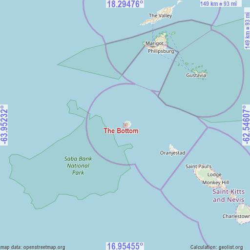
The Bottom GPS coordinates[2]
17° 37' 33.24" North, 63° 14' 57.084" West
| Map corner | latitude | longitude |
|---|---|---|
| Upper-left | 18.29476°, | -63.95232° |
| Center: | 17.6259°, | -63.24919° |
| Lower-right: | 16.95455°, | -62.54607° |
| Map W x H: | 149×149 km | = 92.6×92.6mi |
| max Lat: | 17.643° ⇑14.3% North |
| The Bottom: | 17.6259° |
| min Lat: | ⇓85.7% South 12.13333° |
| min Long | The Bottom | max Long |
| -68.33333° | -63.24919° | -62.98333° |
| W 57.1%⇐ | ⇒42.9% E |
Elevation
Elevation of The Bottom is 222 m = 728 ft, and this is 140.1 m = 460 ft above average elevation for this country.
| Max E: |
222 m = 728 ft | 0% |
| The Bottom | 222 m 728 ft | |
| Avg. | 81.9 m = 269 ft | |
Min E: |
4 m = 13 ft | 100% |
See also: Bonaire, Saint Eustatius and Saba elevation on elevation.city.
Geographical zone
The Bottom is located in North Torrid zone (between Equator and Tropic of Cancer). Distance of this Northern Tropic circle is 646.1 km =401.5 mi to North.| Distance of | km | miles | from The Bottom |
|---|---|---|---|
| North Pole | 8047.2 | 5000.3 | to North |
| Arctic Circle | 5441.4 | 3381.1 | to North |
| Tropic Cancer | 646.1 | 401.5 | to North |
| Equator | 1959.8 | 1217.8 | to South |


Nearby cities:
3 places around The Bottom: (largest is in red/bold)
• Golden Rock
32.3 km =20.1 mi,  119°
119°
• Oranjestad
32.1 km =19.9 mi, 119°
• Upper Hell's Gate
3.1 km =1.9 mi,  51°
51°
Sources, notices
• [Note1] Compared only with cities in Bonaire, Saint Eustatius and Saba existing in our database
• [Src1] Map data: © OpenStreetMap contributors (CC-BY-SA)
• [Src2] Other city data from geonames.org with taken over terms of usage.
• [Src3] Geographical zone / Annual Mean Temperature by Robert A. Rohde @ Wikipedia
