Salihorsk geodata
Salihorsk (Minsk) is a seat of a second-order administrative division; located in Belarus in Europe/Minsk (GMT+3) time zone. With population of 101,614 people, there are 12 cities with bigger population in this country. Compared to other cities in Belarus, 79.6% of cities are located further ↑North; 55.3% of cities are located further →East and 60.5% of cities have higher elevation than Salihorsk. Note1


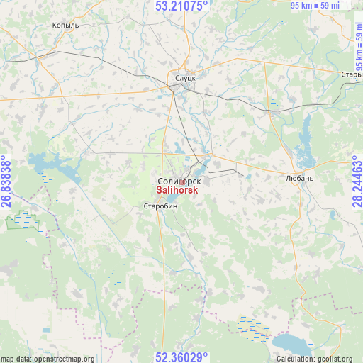
Salihorsk GPS coordinates[2]
52° 47' 15.36" North, 27° 32' 29.4" East
| Map corner | latitude | longitude |
|---|---|---|
| Upper-left | 53.21075°, | 26.83838° |
| Center: | 52.7876°, | 27.5415° |
| Lower-right: | 52.36029°, | 28.24463° |
| Map W x H: | 94.6×94.6 km | = 58.8×58.8mi |
| max Lat: | 56.0147° ⇑79.6% North |
| Salihorsk: | 52.7876° |
| min Lat: | ⇓20.4% South 51.75° |
| min Long | Salihorsk | max Long |
| 23.37083° | 27.5415° | 32.578° |
| W 44.7%⇐ | ⇒55.3% E |
Elevation
Elevation of Salihorsk is 157 m = 515 ft, and this is 11.6 m = 38 ft below average elevation for this country.
| Max E: |
309 m = 1014 ft | 60.5% |
| Avg. | 168.6 m = 553 ft | |
| Salihorsk | 157 m = 515 ft | |
Min E: |
108 m = 354 ft | 39.5% |
See also: Salihorsk elevation on elevation.city.
Geographical zone
Salihorsk is located in North temperate zone (between Tropic of Cancer and the Arctic Circle). Distance of this North polar circle is 1531.7 km =951.8 mi to North.| Distance of | km | miles | from Salihorsk |
|---|---|---|---|
| North Pole | 4137.6 | 2571 | to North |
| Arctic Circle | 1531.7 | 951.8 | to North |
| Tropic Cancer | 3263.5 | 2027.8 | to South |
| Equator | 5869.4 | 3647.1 | to South |


Nearby cities:
15 places around Salihorsk: (largest is in red/bold)
• Chyrvonaya Slabada
26 km =16.2 mi,  286°
286°
• Hantsavichy
74.8 km =46.5 mi,  267°
267°
• Hotsk
40.2 km =25 mi,  222°
222°
• Kapyl’
50.5 km =31.4 mi,  323°
323°
• Klyetsk
68.2 km =42.4 mi,  296°
296°
• Lyuban’
31.2 km =19.4 mi,  87°
87°
• Mikashevichy
63.6 km =39.5 mi,  183°
183°
• Nyasvizh
75.1 km =46.7 mi,  309°
309°
• Sarachy
32.1 km =19.9 mi, 90°
• Slutsk
26.7 km =16.6 mi,  2°
2°
• Starobin
8.7 km =5.4 mi, 218°
• Staryya Darohi
56.2 km =34.9 mi,  59°
59°
• Tsimkavichy
48.3 km =30 mi, 310°
• Urechcha
29.6 km =18.4 mi,  52°
52°
• Zhytkavichy
66.9 km =41.6 mi,  161°
161°
Sources, notices
• [Note1] Compared only with cities in Belarus existing in our database
• [Src1] Map data: © OpenStreetMap contributors (CC-BY-SA)
• [Src2] Other city data from geonames.org with taken over terms of usage.
• [Src3] Geographical zone / Annual Mean Temperature by Robert A. Rohde @ Wikipedia
