Cadenazzo geodata
Cadenazzo (Ticino) is a populated place; located in Switzerland in Europe/Zurich (GMT+2) time zone. With population of 1,906 people, there are 871 cities with bigger population in this country. Compared to other cities in Switzerland, 96.4% of cities are located further ↑North; 86% of cities are located further ←West and 99.8% of cities have higher elevation than Cadenazzo. Note1


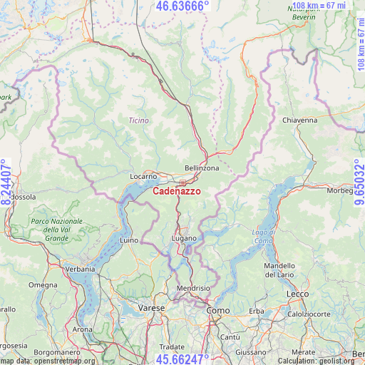
Cadenazzo GPS coordinates[2]
46° 9' 6.192" North, 8° 56' 49.884" East
| Map corner | latitude | longitude |
|---|---|---|
| Upper-left | 46.63666°, | 8.24407° |
| Center: | 46.15172°, | 8.94719° |
| Lower-right: | 45.66247°, | 9.65032° |
| Map W x H: | 108.3×108.3 km | = 67.3×67.3mi |
| max Lat: | 47.76737° ⇑96.4% North |
| Cadenazzo: | 46.15172° |
| min Lat: | ⇓3.6% South 45.83203° |
| min Long | Cadenazzo | max Long |
| 5.97153° | 8.94719° | 10.44624° |
| W 86%⇐ | ⇒14% E |
Elevation
Elevation of Cadenazzo is 211 m = 692 ft, and this is 347.2 m = 1139 ft below average elevation for this country.
| Max E: |
1845 m = 6053 ft | 99.8% |
| Avg. | 558.2 m = 1831 ft | |
| Cadenazzo | 211 m = 692 ft | |
Min E: |
197 m = 646 ft | 0.2% |
See also: Switzerland elevation on elevation.city.
Geographical zone
Cadenazzo is located in North temperate zone (between Tropic of Cancer and the Arctic Circle). Distance of this North polar circle is 2269.6 km =1410.3 mi to North.| Distance of | km | miles | from Cadenazzo |
|---|---|---|---|
| North Pole | 4875.5 | 3029.5 | to North |
| Arctic Circle | 2269.6 | 1410.3 | to North |
| Tropic Cancer | 2525.7 | 1569.4 | to South |
| Equator | 5131.6 | 3188.6 | to South |


Nearby cities:
15 places around Cadenazzo: (largest is in red/bold)
• Bellinzona
7.1 km =4.4 mi,  49°
49°
• Bironico
4.4 km =2.7 mi,  194°
194°
• Cagiallo
9.6 km =6 mi,  167°
167°
• Camorino
4.7 km =2.9 mi,  72°
72°
• Contone
1.6 km =1 mi,  266°
266°
• Cugnasco
3.5 km =2.2 mi,  317°
317°
• Giubiasco
5.2 km =3.2 mi,  63°
63°
• Gordola
7.1 km =4.4 mi,  298°
298°
• Gorduno
9.6 km =6 mi,  41°
41°
• Magadino
7 km =4.3 mi, 267°
• Monte Carasso
5.6 km =3.5 mi, 45°
• Pianezzo
6.3 km =3.9 mi, 71°
• Sementina
4.9 km =3 mi, 43°
• Tesserete
9.4 km =5.8 mi, 171°
• Vira
8.2 km =5.1 mi,  263°
263°
Sources, notices
• [Note1] Compared only with cities in Switzerland existing in our database
• [Src1] Map data: © OpenStreetMap contributors (CC-BY-SA)
• [Src2] Other city data from geonames.org with taken over terms of usage.
• [Src3] Geographical zone / Annual Mean Temperature by Robert A. Rohde @ Wikipedia
