Xiage geodata
Xiage (Zhejiang) is a seat of a fourth-order administrative division; located in China in Asia/Shanghai (GMT+8) time zone. In our database, there are 1268 cities with bigger population. Compared to other cities in China, 66.7% of cities are located further ↑North; 87.1% of cities are located further ←West and 75.3% of cities have higher elevation than Xiage. Note1


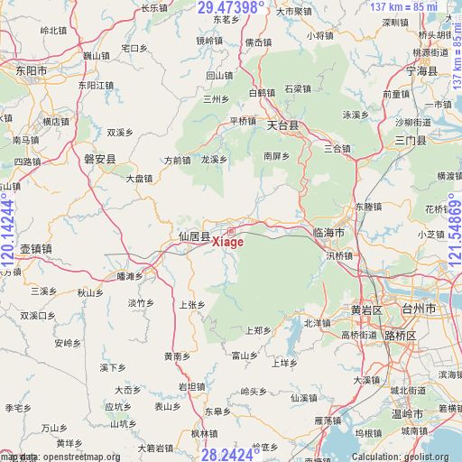
Xiage GPS coordinates[2]
28° 51' 36.036" North, 120° 50' 44.016" East
| Map corner | latitude | longitude |
|---|---|---|
| Upper-left | 29.47398°, | 120.14244° |
| Center: | 28.86001°, | 120.84556° |
| Lower-right: | 28.2424°, | 121.54869° |
| Map W x H: | 136.9×136.9 km | = 85.1×85.1mi |
| max Lat: | 53.31946° ⇑66.7% North |
| Xiage: | 28.86001° |
| min Lat: | ⇓33.3% South 18.22056° |
| min Long | Xiage | max Long |
| 75.07348° | 120.84556° | 134.28917° |
| W 87.1%⇐ | ⇒12.9% E |
Elevation
Elevation of Xiage is 36 m = 118 ft, and this is 448.8 m = 1472 ft below average elevation for this country.
| Max E: |
5622 m = 18445 ft | 75.3% |
| Avg. | 484.8 m = 1591 ft | |
| Xiage | 36 m = 118 ft | |
Min E: |
-3 m = -10 ft | 24.7% |
See also: China elevation on elevation.city.
Geographical zone
Xiage is located in North temperate zone (between Tropic of Cancer and the Arctic Circle). Distance of this Northern Tropic circle is 603 km =374.7 mi to South.| Distance of | km | miles | from Xiage |
|---|---|---|---|
| North Pole | 6798.1 | 4224.1 | to North |
| Arctic Circle | 4192.2 | 2604.9 | to North |
| Tropic Cancer | 603 | 374.7 | to South |
| Equator | 3208.9 | 1993.9 | to South |


Nearby cities:
15 places around Xiage: (largest is in red/bold)
• Anzhou
12.7 km =7.9 mi,  278°
278°
• Baishuiyang
6.2 km =3.9 mi,  48°
48°
• Bulu
14.6 km =9.1 mi,  242°
242°
• Dazhan
5.2 km =3.2 mi,  215°
215°
• Fuying
12.3 km =7.6 mi,  271°
271°
• Guangdu
14.3 km =8.9 mi,  315°
315°
• Guanlu
18.4 km =11.4 mi,  260°
260°
• Kuocang
13.3 km =8.3 mi,  90°
90°
• Nanfeng
10.5 km =6.5 mi, 269°
• Shuangmiao
7.2 km =4.5 mi,  178°
178°
• Tianshi
22.6 km =14 mi,  247°
247°
• Weixin
24 km =14.9 mi,  289°
289°
• Xianju
11.1 km =6.9 mi, 266°
• Yongfeng
22.1 km =13.7 mi,  79°
79°
• Zhuxi
15 km =9.3 mi, 184°
Sources, notices
• [Note1] Compared only with cities in China existing in our database
• [Src1] Map data: © OpenStreetMap contributors (CC-BY-SA)
• [Src2] Other city data from geonames.org with taken over terms of usage.
• [Src3] Geographical zone / Annual Mean Temperature by Robert A. Rohde @ Wikipedia
