Wenfeng geodata
Wenfeng (Jiangxi) is a seat of a third-order administrative division; located in China in Asia/Shanghai (GMT+8) time zone. In our database, there are 1268 cities with bigger population. Compared to other cities in China, 77.8% of cities are located further ↑North; 55% of cities are located further ←West and 71% of cities have higher elevation than Wenfeng. Note1


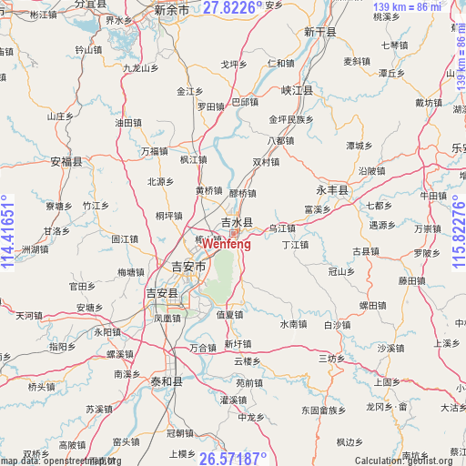
Wenfeng GPS coordinates[2]
27° 11' 56.364" North, 115° 7' 10.668" East
| Map corner | latitude | longitude |
|---|---|---|
| Upper-left | 27.8226°, | 114.41651° |
| Center: | 27.19899°, | 115.11963° |
| Lower-right: | 26.57187°, | 115.82276° |
| Map W x H: | 139.1×139.1 km | = 86.4×86.4mi |
| max Lat: | 53.31946° ⇑77.8% North |
| Wenfeng: | 27.19899° |
| min Lat: | ⇓22.2% South 18.22056° |
| min Long | Wenfeng | max Long |
| 75.07348° | 115.11963° | 134.28917° |
| W 55%⇐ | ⇒45% E |
Elevation
Elevation of Wenfeng is 48 m = 157 ft, and this is 436.8 m = 1433 ft below average elevation for this country.
| Max E: |
5622 m = 18445 ft | 71% |
| Avg. | 484.8 m = 1591 ft | |
| Wenfeng | 48 m = 157 ft | |
Min E: |
-3 m = -10 ft | 29% |
See also: China elevation on elevation.city.
Geographical zone
Wenfeng is located in North temperate zone (between Tropic of Cancer and the Arctic Circle). Distance of this Northern Tropic circle is 418.3 km =259.9 mi to South.| Distance of | km | miles | from Wenfeng |
|---|---|---|---|
| North Pole | 6982.8 | 4338.9 | to North |
| Arctic Circle | 4376.9 | 2719.7 | to North |
| Tropic Cancer | 418.3 | 259.9 | to South |
| Equator | 3024.2 | 1879.2 | to South |


Nearby cities:
15 places around Wenfeng: (largest is in red/bold)
• Bajiang
22.9 km =14.2 mi,  88°
88°
• Changtang
15 km =9.3 mi,  266°
266°
• Dingjiang
18.3 km =11.4 mi,  100°
100°
• Futan
23.3 km =14.5 mi,  172°
172°
• Hebu
18.6 km =11.6 mi,  234°
234°
• Huangqiao
15.1 km =9.4 mi,  330°
330°
• Jintan
8.1 km =5 mi,  359°
359°
• Jizhou
13.7 km =8.5 mi,  243°
243°
• Ji’an
16.6 km =10.3 mi, 236°
• Laoqiao
11.7 km =7.3 mi,  10°
10°
• Tianyu
9.2 km =5.7 mi, 225°
• Tongping
20.1 km =12.5 mi,  286°
286°
• Wujiang
14.4 km =8.9 mi,  83°
83°
• Yonghe
21.4 km =13.3 mi,  209°
209°
• Zhangshan
7.6 km =4.7 mi,  258°
258°
Sources, notices
• [Note1] Compared only with cities in China existing in our database
• [Src1] Map data: © OpenStreetMap contributors (CC-BY-SA)
• [Src2] Other city data from geonames.org with taken over terms of usage.
• [Src3] Geographical zone / Annual Mean Temperature by Robert A. Rohde @ Wikipedia
