Xinhui geodata
Xinhui (Guangdong) is a populated place; located in China in Asia/Shanghai (GMT+8) time zone. With population of 195,129 people, there are 234 cities with bigger population in this country. Compared to other cities in China, 96.5% of cities are located further ↑North; 57.3% of cities are located further →East and 99.9% of cities have higher elevation than Xinhui. Note1


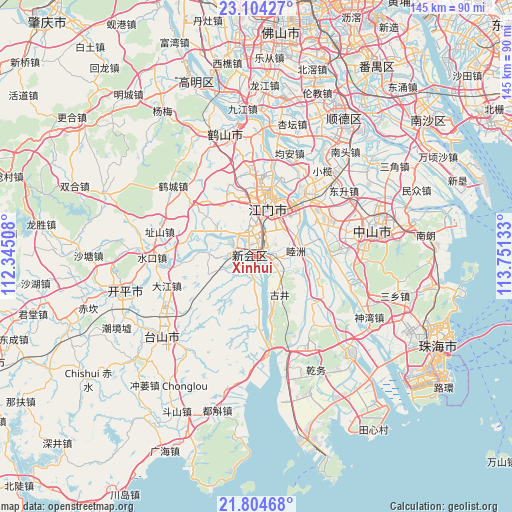
Xinhui GPS coordinates[2]
22° 27' 21.6" North, 113° 2' 53.52" East
| Map corner | latitude | longitude |
|---|---|---|
| Upper-left | 23.10427°, | 112.34508° |
| Center: | 22.456°, | 113.0482° |
| Lower-right: | 21.80468°, | 113.75133° |
| Map W x H: | 144.5×144.5 km | = 89.8×89.8mi |
| max Lat: | 53.31946° ⇑96.5% North |
| Xinhui: | 22.456° |
| min Lat: | ⇓3.5% South 18.22056° |
| min Long | Xinhui | max Long |
| 75.07348° | 113.0482° | 134.28917° |
| W 42.7%⇐ | ⇒57.3% E |
Elevation
Elevation of Xinhui is 0 m = 0 ft, and this is 484.8 m = 1591 ft below average elevation for this country.
| Max E: |
5622 m = 18445 ft | 99.9% |
| Avg. | 484.8 m = 1591 ft | |
| Xinhui | 0 m = 0 ft | |
Min E: |
-3 m = -10 ft | 0.1% |
See also: Xinhui elevation on elevation.city.
Geographical zone
Xinhui is located in North Torrid zone (between Equator and Tropic of Cancer). Distance of this Northern Tropic circle is 109 km =67.7 mi to North.| Distance of | km | miles | from Xinhui |
|---|---|---|---|
| North Pole | 7510.2 | 4666.6 | to North |
| Arctic Circle | 4904.3 | 3047.4 | to North |
| Tropic Cancer | 109 | 67.7 | to North |
| Equator | 2496.9 | 1551.5 | to South |


Nearby cities:
15 places around Xinhui: (largest is in red/bold)
• Baisha
13.6 km =8.5 mi,  10°
10°
• Canghou
15.2 km =9.4 mi, 7°
• Daze
13.8 km =8.6 mi,  301°
301°
• Gujing
12.8 km =8 mi,  151°
151°
• Huanshi
15.4 km =9.6 mi, 7°
• Huicheng
8 km =5 mi,  346°
346°
• Jianghai
15.1 km =9.4 mi,  28°
28°
• Jiangmen
14.6 km =9.1 mi, 14°
• Jiaotou
14 km =8.7 mi,  19°
19°
• Lianjiang
15.2 km =9.4 mi, 10°
• Lile
9.6 km =6 mi, 21°
• Luokeng
13.2 km =8.2 mi,  273°
273°
• Muzhou
11.6 km =7.2 mi,  89°
89°
• Sanjiang
6.1 km =3.8 mi,  112°
112°
• Shuangshui
6 km =3.7 mi,  247°
247°
In other languages:
- In France: District de Xinhui
- In Chinese: Hsin-hui-chiu-ch’eng, Hui-ch’eng-chen, 新会区
Sources, notices
• [Note1] Compared only with cities in China existing in our database
• [Src1] Map data: © OpenStreetMap contributors (CC-BY-SA)
• [Src2] Other city data from geonames.org with taken over terms of usage.
• [Src3] Geographical zone / Annual Mean Temperature by Robert A. Rohde @ Wikipedia
