Guangyi geodata
Guangyi (Guangdong) is a seat of a fourth-order administrative division; located in China in Asia/Shanghai (GMT+8) time zone. In our database, there are 1268 cities with bigger population. Compared to other cities in China, 92.3% of cities are located further ↑North; 64.7% of cities are located further ←West and 89.9% of cities have higher elevation than Guangyi. Note1


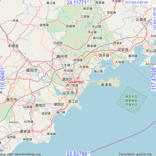
Guangyi GPS coordinates[2]
23° 28' 27.696" North, 116° 46' 1.668" East
| Map corner | latitude | longitude |
|---|---|---|
| Upper-left | 24.11771°, | 116.06401° |
| Center: | 23.47436°, | 116.76713° |
| Lower-right: | 22.82786°, | 117.47026° |
| Map W x H: | 143.4×143.4 km | = 89.1×89.1mi |
| max Lat: | 53.31946° ⇑92.3% North |
| Guangyi: | 23.47436° |
| min Lat: | ⇓7.7% South 18.22056° |
| min Long | Guangyi | max Long |
| 75.07348° | 116.76713° | 134.28917° |
| W 64.7%⇐ | ⇒35.3% E |
Elevation
Elevation of Guangyi is 10 m = 33 ft, and this is 474.8 m = 1558 ft below average elevation for this country.
| Max E: |
5622 m = 18445 ft | 89.9% |
| Avg. | 484.8 m = 1591 ft | |
| Guangyi | 10 m = 33 ft | |
Min E: |
-3 m = -10 ft | 10.1% |
See also: China elevation on elevation.city.
Geographical zone
Guangyi is located in North temperate zone (between Tropic of Cancer and the Arctic Circle). Distance of this Northern Tropic circle is 4.2 km =2.6 mi to South.| Distance of | km | miles | from Guangyi |
|---|---|---|---|
| North Pole | 7397 | 4596.3 | to North |
| Arctic Circle | 4791.1 | 2977.1 | to North |
| Tropic Cancer | 4.2 | 2.6 | to South |
| Equator | 2610.1 | 1621.8 | to South |


Nearby cities:
15 places around Guangyi: (largest is in red/bold)
• Anbu
9.2 km =5.7 mi,  252°
252°
• Caitang
10.6 km =6.6 mi,  278°
278°
• Chenghua
1.5 km =0.9 mi,  168°
168°
• Dongfeng
11.5 km =7.1 mi,  310°
310°
• Dongli
10.7 km =6.6 mi,  25°
25°
• Lianhua
11.8 km =7.3 mi,  16°
16°
• Lianshang
5.9 km =3.7 mi, 27°
• Lianxia
3 km =1.9 mi,  10°
10°
• Longdu
11.8 km =7.3 mi,  337°
337°
• Longxiang
8.5 km =5.3 mi,  213°
213°
• Outing
8.5 km =5.3 mi,  220°
220°
• Shanghua
8.1 km =5 mi, 312°
• Waisha
4.7 km =2.9 mi,  202°
202°
• Xinan
9 km =5.6 mi, 27°
• Xinxi
8 km =5 mi,  178°
178°
Sources, notices
• [Note1] Compared only with cities in China existing in our database
• [Src1] Map data: © OpenStreetMap contributors (CC-BY-SA)
• [Src2] Other city data from geonames.org with taken over terms of usage.
• [Src3] Geographical zone / Annual Mean Temperature by Robert A. Rohde @ Wikipedia
