Kuangshan geodata
Kuangshan (Henan) is a seat of a fourth-order administrative division; located in China in Asia/Shanghai (GMT+8) time zone. In our database, there are 1268 cities with bigger population. Compared to other cities in China, 67.6% of cities are located further ↓South; 54.4% of cities are located further →East and 60.4% of cities have higher elevation than Kuangshan. Note1


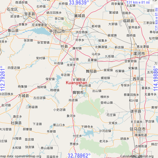
Kuangshan GPS coordinates[2]
33° 22' 43.464" North, 113° 29' 44.628" East
| Map corner | latitude | longitude |
|---|---|---|
| Upper-left | 33.9639°, | 112.79261° |
| Center: | 33.37874°, | 113.49573° |
| Lower-right: | 32.78962°, | 114.19886° |
| Map W x H: | 130.6×130.6 km | = 81.2×81.2mi |
| max Lat: | 53.31946° ⇑32.4% North |
| Kuangshan: | 33.37874° |
| min Lat: | ⇓67.6% South 18.22056° |
| min Long | Kuangshan | max Long |
| 75.07348° | 113.49573° | 134.28917° |
| W 45.6%⇐ | ⇒54.4% E |
Elevation
Elevation of Kuangshan is 96 m = 315 ft, and this is 388.8 m = 1276 ft below average elevation for this country.
| Max E: |
5622 m = 18445 ft | 60.4% |
| Avg. | 484.8 m = 1591 ft | |
| Kuangshan | 96 m = 315 ft | |
Min E: |
-3 m = -10 ft | 39.6% |
See also: China elevation on elevation.city.
Geographical zone
Kuangshan is located in North temperate zone (between Tropic of Cancer and the Arctic Circle). Distance of this Northern Tropic circle is 1105.4 km =686.9 mi to South.| Distance of | km | miles | from Kuangshan |
|---|---|---|---|
| North Pole | 6295.7 | 3912 | to North |
| Arctic Circle | 3689.8 | 2292.7 | to North |
| Tropic Cancer | 1105.4 | 686.9 | to South |
| Equator | 3711.4 | 2306.2 | to South |


Nearby cities:
15 places around Kuangshan: (largest is in red/bold)
• Baohe
9.2 km =5.7 mi,  16°
16°
• Longquan
13.8 km =8.6 mi,  331°
331°
• Miaojie
3.8 km =2.4 mi,  231°
231°
• Sipo
11.1 km =6.9 mi,  169°
169°
• Tieshan
6 km =3.7 mi,  148°
148°
• Wenfeng
10.6 km =6.6 mi,  44°
44°
• Wugong
8.5 km =5.3 mi,  125°
125°
• Wuquan
10.1 km =6.3 mi, 43°
• Xindian
12.1 km =7.5 mi,  288°
288°
• Yakou
9.5 km =5.9 mi,  164°
164°
• Yangzhuang
12.3 km =7.6 mi,  186°
186°
• Yinji
16 km =9.9 mi, 152°
• Yuanling
11.2 km =7 mi,  197°
197°
• Zaolin
8.4 km =5.2 mi,  99°
99°
• Zhulan
7.3 km =4.5 mi, 154°
Sources, notices
• [Note1] Compared only with cities in China existing in our database
• [Src1] Map data: © OpenStreetMap contributors (CC-BY-SA)
• [Src2] Other city data from geonames.org with taken over terms of usage.
• [Src3] Geographical zone / Annual Mean Temperature by Robert A. Rohde @ Wikipedia
