Gaoliang geodata
Gaoliang (Chongqing) is a seat of a fourth-order administrative division; located in China in Asia/Shanghai (GMT+8) time zone. In our database, there are 1268 cities with bigger population. Compared to other cities in China, 53.1% of cities are located further ↓South; 79.5% of cities are located further →East and 53.1% of cities have lower elevation than Gaoliang. Note1


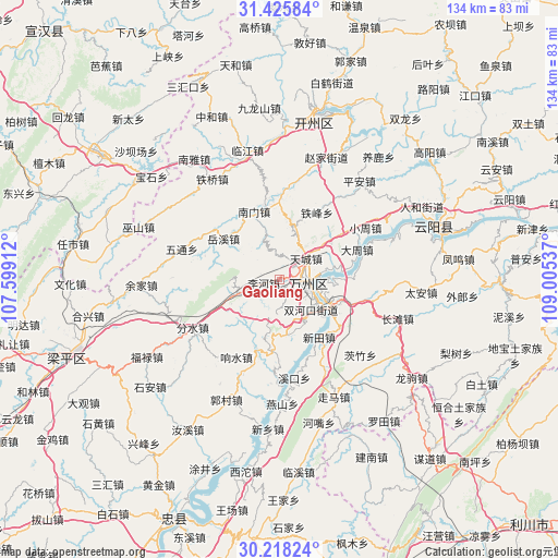
Gaoliang GPS coordinates[2]
30° 49' 26.184" North, 108° 18' 8.064" East
| Map corner | latitude | longitude |
|---|---|---|
| Upper-left | 31.42584°, | 107.59912° |
| Center: | 30.82394°, | 108.30224° |
| Lower-right: | 30.21824°, | 109.00537° |
| Map W x H: | 134.3×134.3 km | = 83.5×83.5mi |
| max Lat: | 53.31946° ⇑46.9% North |
| Gaoliang: | 30.82394° |
| min Lat: | ⇓53.1% South 18.22056° |
| min Long | Gaoliang | max Long |
| 75.07348° | 108.30224° | 134.28917° |
| W 20.5%⇐ | ⇒79.5% E |
Elevation
Elevation of Gaoliang is 189 m = 620 ft, and this is 295.8 m = 970 ft below average elevation for this country.
| Max E: |
5622 m = 18445 ft | 46.9% |
| Avg. | 484.8 m = 1591 ft | |
| Gaoliang | 189 m = 620 ft | |
Min E: |
-3 m = -10 ft | 53.1% |
See also: China elevation on elevation.city.
Geographical zone
Gaoliang is located in North temperate zone (between Tropic of Cancer and the Arctic Circle). Distance of this Northern Tropic circle is 821.4 km =510.4 mi to South.| Distance of | km | miles | from Gaoliang |
|---|---|---|---|
| North Pole | 6579.8 | 4088.5 | to North |
| Arctic Circle | 3973.9 | 2469.3 | to North |
| Tropic Cancer | 821.4 | 510.4 | to South |
| Equator | 3427.3 | 2129.6 | to South |


Nearby cities:
15 places around Gaoliang: (largest is in red/bold)
• Bai’anba
14.6 km =9.1 mi,  117°
117°
• Chenjiaba
6.9 km =4.3 mi,  99°
99°
• Gaofeng
12.9 km =8 mi,  162°
162°
• Jiuchi
7.1 km =4.4 mi,  113°
113°
• Lihe
3.9 km =2.4 mi,  257°
257°
• Pailou
8.5 km =5.3 mi, 110°
• Shuanghekou
10.1 km =6.3 mi,  140°
140°
• Taibai
5.3 km =3.3 mi,  88°
88°
• Tiancheng
8.1 km =5 mi,  52°
52°
• Wanxian
6.6 km =4.1 mi, 98°
• Wuqiao
15.4 km =9.6 mi, 108°
• Xiongjia
15.2 km =9.4 mi,  55°
55°
• Zhonggulou
7.8 km =4.8 mi, 89°
• Zhoujiaba
6.5 km =4 mi,  70°
70°
• Zhushan
10.5 km =6.5 mi,  194°
194°
Sources, notices
• [Note1] Compared only with cities in China existing in our database
• [Src1] Map data: © OpenStreetMap contributors (CC-BY-SA)
• [Src2] Other city data from geonames.org with taken over terms of usage.
• [Src3] Geographical zone / Annual Mean Temperature by Robert A. Rohde @ Wikipedia
