Longsha geodata
Longsha (Chongqing) is a seat of a fourth-order administrative division; located in China in Asia/Shanghai (GMT+8) time zone. In our database, there are 1268 cities with bigger population. Compared to other cities in China, 51.5% of cities are located further ↓South; 79.7% of cities are located further →East and 75.9% of cities have lower elevation than Longsha. Note1


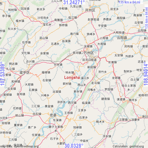
Longsha GPS coordinates[2]
30° 38' 22.74" North, 108° 14' 13.236" East
| Map corner | latitude | longitude |
|---|---|---|
| Upper-left | 31.24271°, | 107.53389° |
| Center: | 30.63965°, | 108.23701° |
| Lower-right: | 30.0328°, | 108.94014° |
| Map W x H: | 134.5×134.5 km | = 83.6×83.6mi |
| max Lat: | 53.31946° ⇑48.5% North |
| Longsha: | 30.63965° |
| min Lat: | ⇓51.5% South 18.22056° |
| min Long | Longsha | max Long |
| 75.07348° | 108.23701° | 134.28917° |
| W 20.3%⇐ | ⇒79.7% E |
Elevation
Elevation of Longsha is 543 m = 1781 ft, and this is 58.2 m = 191 ft above average elevation for this country.
| Max E: |
5622 m = 18445 ft | 24.1% |
| Longsha | 543 m 1781 ft | |
| Avg. | 484.8 m = 1591 ft | |
Min E: |
-3 m = -10 ft | 75.9% |
See also: China elevation on elevation.city.
Geographical zone
Longsha is located in North temperate zone (between Tropic of Cancer and the Arctic Circle). Distance of this Northern Tropic circle is 800.9 km =497.7 mi to South.| Distance of | km | miles | from Longsha |
|---|---|---|---|
| North Pole | 6600.3 | 4101.2 | to North |
| Arctic Circle | 3994.4 | 2482 | to North |
| Tropic Cancer | 800.9 | 497.7 | to South |
| Equator | 3406.8 | 2116.9 | to South |


Nearby cities:
15 places around Longsha: (largest is in red/bold)
• Fenshui
17.2 km =10.7 mi,  301°
301°
• Ganning
5.3 km =3.3 mi,  51°
51°
• Gaofeng
12.9 km =8 mi, 50°
• Guocun
10.4 km =6.5 mi,  218°
218°
• Lihe
19.8 km =12.3 mi,  6°
6°
• Rangdu
8.4 km =5.2 mi,  128°
128°
• Shuanghekou
18 km =11.2 mi,  44°
44°
• Wuling
15 km =9.3 mi,  171°
171°
• Xiangshui
4.5 km =2.8 mi,  292°
292°
• Xikou
10.3 km =6.4 mi,  108°
108°
• Xintian
17.1 km =10.6 mi,  67°
67°
• Xinxiang
15.9 km =9.9 mi, 167°
• Yanshan
11.7 km =7.3 mi,  143°
143°
• Yehe
15.6 km =9.7 mi, 223°
• Zhushan
11 km =6.8 mi,  18°
18°
Sources, notices
• [Note1] Compared only with cities in China existing in our database
• [Src1] Map data: © OpenStreetMap contributors (CC-BY-SA)
• [Src2] Other city data from geonames.org with taken over terms of usage.
• [Src3] Geographical zone / Annual Mean Temperature by Robert A. Rohde @ Wikipedia
