Kangyang geodata
Kangyang (Qinghai) is a seat of a fourth-order administrative division; located in China in Asia/Shanghai (GMT+8) time zone. In our database, there are 1268 cities with bigger population. Compared to other cities in China, 77.3% of cities are located further ↓South; 93% of cities are located further →East and 94.9% of cities have lower elevation than Kangyang. Note1


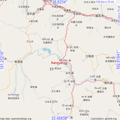
Kangyang GPS coordinates[2]
36° 3' 32.544" North, 101° 54' 55.008" East
| Map corner | latitude | longitude |
|---|---|---|
| Upper-left | 36.6254°, | 101.21216° |
| Center: | 36.05904°, | 101.91528° |
| Lower-right: | 35.48858°, | 102.61841° |
| Map W x H: | 126.4×126.4 km | = 78.5×78.5mi |
| max Lat: | 53.31946° ⇑22.7% North |
| Kangyang: | 36.05904° |
| min Lat: | ⇓77.3% South 18.22056° |
| min Long | Kangyang | max Long |
| 75.07348° | 101.91528° | 134.28917° |
| W 7%⇐ | ⇒93% E |
Elevation
Elevation of Kangyang is 2076 m = 6811 ft, and this is 1591.2 m = 5220 ft above average elevation for this country.
| Max E: |
5622 m = 18445 ft | 5.1% |
| Kangyang | 2076 m 6811 ft | |
| Avg. | 484.8 m = 1591 ft | |
Min E: |
-3 m = -10 ft | 94.9% |
See also: China elevation on elevation.city.
Geographical zone
Kangyang is located in North temperate zone (between Tropic of Cancer and the Arctic Circle). Distance of this Northern Tropic circle is 1403.5 km =872.1 mi to South.| Distance of | km | miles | from Kangyang |
|---|---|---|---|
| North Pole | 5997.7 | 3726.8 | to North |
| Arctic Circle | 3391.8 | 2107.6 | to North |
| Tropic Cancer | 1403.5 | 872.1 | to South |
| Equator | 4009.4 | 2491.3 | to South |


Nearby cities:
15 places around Kangyang: (largest is in red/bold)
• Angla
22 km =13.7 mi,  149°
149°
• Cuozhou
11.7 km =7.3 mi,  181°
181°
• Dangshun
25.7 km =16 mi,  157°
157°
• Dehenglong
22.6 km =14 mi,  114°
114°
• Gucheng
33.9 km =21.1 mi,  12°
12°
• Jiajia
9.5 km =5.9 mi,  209°
209°
• Jianzhatan
32.8 km =20.4 mi,  187°
187°
• Kanbula
8.5 km =5.3 mi,  315°
315°
• Magitang
16.9 km =10.5 mi,  142°
142°
• Nengke
21.2 km =13.2 mi,  168°
168°
• Qunke
6.1 km =3.8 mi,  100°
100°
• Shalianbao
18.5 km =11.5 mi, 107°
• Shihuiyao
36.1 km =22.4 mi,  355°
355°
• Sitai
34.3 km =21.3 mi,  2°
2°
• Yashiga
2.3 km =1.4 mi,  53°
53°
Sources, notices
• [Note1] Compared only with cities in China existing in our database
• [Src1] Map data: © OpenStreetMap contributors (CC-BY-SA)
• [Src2] Other city data from geonames.org with taken over terms of usage.
• [Src3] Geographical zone / Annual Mean Temperature by Robert A. Rohde @ Wikipedia
