Xiaojiangba geodata
Xiaojiangba (Anhui) is a seat of a fourth-order administrative division; located in China in Asia/Shanghai (GMT+8) time zone. In our database, there are 1268 cities with bigger population. Compared to other cities in China, 56.9% of cities are located further ↓South; 70.8% of cities are located further ←West and 85.5% of cities have higher elevation than Xiaojiangba. Note1


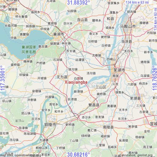
Xiaojiangba GPS coordinates[2]
31° 17' 5.82" North, 118° 3' 43.668" East
| Map corner | latitude | longitude |
|---|---|---|
| Upper-left | 31.88392°, | 117.35901° |
| Center: | 31.28495°, | 118.06213° |
| Lower-right: | 30.68216°, | 118.76526° |
| Map W x H: | 133.6×133.6 km | = 83×83mi |
| max Lat: | 53.31946° ⇑43.1% North |
| Xiaojiangba: | 31.28495° |
| min Lat: | ⇓56.9% South 18.22056° |
| min Long | Xiaojiangba | max Long |
| 75.07348° | 118.06213° | 134.28917° |
| W 70.8%⇐ | ⇒29.2% E |
Elevation
Elevation of Xiaojiangba is 15 m = 49 ft, and this is 469.8 m = 1541 ft below average elevation for this country.
| Max E: |
5622 m = 18445 ft | 85.5% |
| Avg. | 484.8 m = 1591 ft | |
| Xiaojiangba | 15 m = 49 ft | |
Min E: |
-3 m = -10 ft | 14.5% |
See also: China elevation on elevation.city.
Geographical zone
Xiaojiangba is located in North temperate zone (between Tropic of Cancer and the Arctic Circle). Distance of this Northern Tropic circle is 872.6 km =542.2 mi to South.| Distance of | km | miles | from Xiaojiangba |
|---|---|---|---|
| North Pole | 6528.5 | 4056.6 | to North |
| Arctic Circle | 3922.6 | 2437.4 | to North |
| Tropic Cancer | 872.6 | 542.2 | to South |
| Equator | 3478.6 | 2161.5 | to South |


Nearby cities:
15 places around Xiaojiangba: (largest is in red/bold)
• Digang
18.2 km =11.3 mi,  197°
197°
• Dougou
9.4 km =5.8 mi,  330°
330°
• Eqiao
24.3 km =15.1 mi,  119°
119°
• Erba
26.4 km =16.4 mi,  75°
75°
• Eshan
28.6 km =17.8 mi,  149°
149°
• Fanyang
25.6 km =15.9 mi, 150°
• Jinghu
29.9 km =18.6 mi, 76°
• Lugang
26 km =16.2 mi,  92°
92°
• Sanjiang
29.3 km =18.2 mi, 76°
• Sanshan
16.9 km =10.5 mi,  113°
113°
• Tongzha
23.2 km =14.4 mi,  16°
16°
• Wucheng
15.2 km =9.4 mi,  269°
269°
• Yijiang
28.6 km =17.8 mi, 83°
• Yuncao
15.4 km =9.6 mi,  4°
4°
• Yuxikou
28.3 km =17.6 mi,  54°
54°
Sources, notices
• [Note1] Compared only with cities in China existing in our database
• [Src1] Map data: © OpenStreetMap contributors (CC-BY-SA)
• [Src2] Other city data from geonames.org with taken over terms of usage.
• [Src3] Geographical zone / Annual Mean Temperature by Robert A. Rohde @ Wikipedia
