Žamberk geodata
Žamberk (Pardubický) is a populated place; located in Czech Republic in Europe/Prague (GMT+2) time zone. With population of 6,082 people, there are 227 cities with bigger population in this country. Compared to other cities in Czech Republic, 70.9% of cities are located further ↓South; 63.8% of cities are located further ←West and 72.1% of cities have lower elevation than Žamberk. Note1


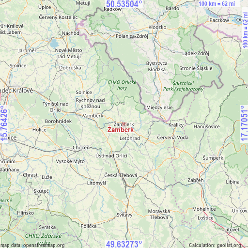
Žamberk GPS coordinates[2]
50° 5' 9.636" North, 16° 28' 2.568" East
| Map corner | latitude | longitude |
|---|---|---|
| Upper-left | 50.53504°, | 15.76426° |
| Center: | 50.08601°, | 16.46738° |
| Lower-right: | 49.63273°, | 17.17051° |
| Map W x H: | 100.3×100.3 km | = 62.3×62.3mi |
| max Lat: | 51.01104° ⇑29.1% North |
| Žamberk: | 50.08601° |
| min Lat: | ⇓70.9% South 48.60378° |
| min Long | Žamberk | max Long |
| 12.17577° | 16.46738° | 18.82683° |
| W 63.8%⇐ | ⇒36.2% E |
Elevation
Elevation of Žamberk is 425 m = 1394 ft, and this is 73 m = 240 ft above average elevation for this country.
| Max E: |
901 m = 2956 ft | 27.9% |
| Žamberk | 425 m 1394 ft | |
| Avg. | 352 m = 1155 ft | |
Min E: |
136 m = 446 ft | 72.1% |
See also: Czech Republic elevation on elevation.city.
Geographical zone
Žamberk is located in North temperate zone (between Tropic of Cancer and the Arctic Circle). Distance of this North polar circle is 1832.1 km =1138.4 mi to North.| Distance of | km | miles | from Žamberk |
|---|---|---|---|
| North Pole | 4438 | 2757.6 | to North |
| Arctic Circle | 1832.1 | 1138.4 | to North |
| Tropic Cancer | 2963.1 | 1841.2 | to South |
| Equator | 5569 | 3460.4 | to South |


Nearby cities:
15 places around Žamberk: (largest is in red/bold)
• Dlouhoňovice
2.5 km =1.6 mi,  226°
226°
• Dolní Dobrouč
10.6 km =6.6 mi,  168°
168°
• Hnátnice
7.6 km =4.7 mi,  195°
195°
• Klášterec nad Orlicí
6.8 km =4.2 mi,  65°
65°
• Kunvald
5.3 km =3.3 mi,  25°
25°
• Letohrad
6 km =3.7 mi,  158°
158°
• Lukavice
3 km =1.9 mi, 159°
• Líšnice
3 km =1.9 mi,  103°
103°
• Mistrovice
10.2 km =6.3 mi,  132°
132°
• Nekoř
6.9 km =4.3 mi,  119°
119°
• Rokytnice v Orlických Horách
8.8 km =5.5 mi,  359°
359°
• Slatina nad Zdobnicí
8 km =5 mi,  314°
314°
• Sopotnice
9.2 km =5.7 mi,  251°
251°
• Těchonín
11 km =6.8 mi, 102°
• Záchlumí
6.6 km =4.1 mi,  279°
279°
Sources, notices
• [Note1] Compared only with cities in Czech Republic existing in our database
• [Src1] Map data: © OpenStreetMap contributors (CC-BY-SA)
• [Src2] Other city data from geonames.org with taken over terms of usage.
• [Src3] Geographical zone / Annual Mean Temperature by Robert A. Rohde @ Wikipedia
