Svitavy geodata
Svitavy (Pardubický) is a populated place; located in Czech Republic in Europe/Prague (GMT+2) time zone. With population of 17,427 people, there are 78 cities with bigger population in this country. Compared to other cities in Czech Republic, 50.5% of cities are located further ↑North; 63.9% of cities are located further ←West and 75.6% of cities have lower elevation than Svitavy. Note1


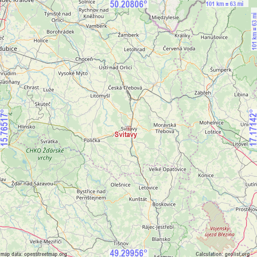
Svitavy GPS coordinates[2]
49° 45' 21.384" North, 16° 28' 5.844" East
| Map corner | latitude | longitude |
|---|---|---|
| Upper-left | 50.20806°, | 15.76517° |
| Center: | 49.75594°, | 16.46829° |
| Lower-right: | 49.29956°, | 17.17142° |
| Map W x H: | 101×101 km | = 62.8×62.8mi |
| max Lat: | 51.01104° ⇑50.5% North |
| Svitavy: | 49.75594° |
| min Lat: | ⇓49.5% South 48.60378° |
| min Long | Svitavy | max Long |
| 12.17577° | 16.46829° | 18.82683° |
| W 63.9%⇐ | ⇒36.1% E |
Elevation
Elevation of Svitavy is 442 m = 1450 ft, and this is 90 m = 295 ft above average elevation for this country.
| Max E: |
901 m = 2956 ft | 24.4% |
| Svitavy | 442 m 1450 ft | |
| Avg. | 352 m = 1155 ft | |
Min E: |
136 m = 446 ft | 75.6% |
See also: Czech Republic elevation on elevation.city.
Geographical zone
Svitavy is located in North temperate zone (between Tropic of Cancer and the Arctic Circle). Distance of this North polar circle is 1868.8 km =1161.2 mi to North.| Distance of | km | miles | from Svitavy |
|---|---|---|---|
| North Pole | 4474.7 | 2780.4 | to North |
| Arctic Circle | 1868.8 | 1161.2 | to North |
| Tropic Cancer | 2926.4 | 1818.4 | to South |
| Equator | 5532.3 | 3437.6 | to South |


Nearby cities:
15 places around Svitavy: (largest is in red/bold)
• Březová nad Svitavou
12.9 km =8 mi,  163°
163°
• Dlouhá Loučka
13.9 km =8.6 mi,  116°
116°
• Hradec nad Svitavou
5 km =3.1 mi,  169°
169°
• Janov
11.2 km =7 mi,  327°
327°
• Koclířov
5.3 km =3.3 mi,  77°
77°
• Kunčina
12.2 km =7.6 mi,  69°
69°
• Opatov
8.1 km =5 mi,  18°
18°
• Opatovec
5.6 km =3.5 mi,  8°
8°
• Pomezí
12 km =7.5 mi,  244°
244°
• Radiměř
6.7 km =4.2 mi,  197°
197°
• Rohozná
12.2 km =7.6 mi, 200°
• Semanín
12.7 km =7.9 mi,  355°
355°
• Třebovice
11.7 km =7.3 mi, 11°
• Vendolí
4.3 km =2.7 mi,  245°
245°
• Čistá
12.8 km =8 mi,  308°
308°
Sources, notices
• [Note1] Compared only with cities in Czech Republic existing in our database
• [Src1] Map data: © OpenStreetMap contributors (CC-BY-SA)
• [Src2] Other city data from geonames.org with taken over terms of usage.
• [Src3] Geographical zone / Annual Mean Temperature by Robert A. Rohde @ Wikipedia
