Kunžak geodata
Kunžak (Jihočeský kraj) is a populated place; located in Czech Republic in Europe/Prague (GMT+2) time zone. With population of 1,484 people, there are 864 cities with bigger population in this country. Compared to other cities in Czech Republic, 85.4% of cities are located further ↑North; 58.8% of cities are located further →East and 94.8% of cities have lower elevation than Kunžak. Note1
Administrative division(s):
- Level 1: Jihočeský kraj
- Level 2: Okres Jindřichův Hradec
- Level 3: Kunžak


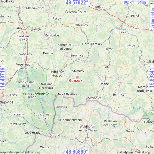
Kunžak GPS coordinates[2]
49° 7' 16.284" North, 15° 11' 25.008" East
| Map corner | latitude | longitude |
|---|---|---|
| Upper-left | 49.57922°, | 14.48716° |
| Center: | 49.12119°, | 15.19028° |
| Lower-right: | 48.65889°, | 15.89341° |
| Map W x H: | 102.3×102.3 km | = 63.6×63.6mi |
| max Lat: | 51.01104° ⇑85.4% North |
| Kunžak: | 49.12119° |
| min Lat: | ⇓14.6% South 48.60378° |
| min Long | Kunžak | max Long |
| 12.17577° | 15.19028° | 18.82683° |
| W 41.2%⇐ | ⇒58.8% E |
Elevation
Elevation of Kunžak is 579 m = 1900 ft, and this is 227 m = 745 ft above average elevation for this country.
| Max E: |
901 m = 2956 ft | 5.2% |
| Kunžak | 579 m 1900 ft | |
| Avg. | 352 m = 1155 ft | |
Min E: |
136 m = 446 ft | 94.8% |
See also: Czech Republic elevation on elevation.city.
Geographical zone
Kunžak is located in North temperate zone (between Tropic of Cancer and the Arctic Circle). Distance of this North polar circle is 1939.4 km =1205.1 mi to North.| Distance of | km | miles | from Kunžak |
|---|---|---|---|
| North Pole | 4545.3 | 2824.3 | to North |
| Arctic Circle | 1939.4 | 1205.1 | to North |
| Tropic Cancer | 2855.8 | 1774.5 | to South |
| Equator | 5461.8 | 3393.8 | to South |


Nearby cities:
15 places around Kunžak: (largest is in red/bold)
• Jarošov nad Nežárkou
11.8 km =7.3 mi,  310°
310°
• Jindřichův Hradec
13.9 km =8.6 mi,  280°
280°
• Krahulčí
17.7 km =11 mi,  67°
67°
• Lásenice
16.9 km =10.5 mi,  251°
251°
• Mrákotín
15.5 km =9.6 mi,  60°
60°
• Nová Bystřice
13 km =8.1 mi,  209°
209°
• Nová Včelnice
15.7 km =9.8 mi,  326°
326°
• Počátky
15.9 km =9.9 mi,  13°
13°
• Strmilov
4.2 km =2.6 mi, 9°
• Studená
10 km =6.2 mi,  44°
44°
• Střížovice
3.2 km =2 mi, 310°
• Volfířov
13.2 km =8.2 mi,  96°
96°
• Český Rudolec
11.4 km =7.1 mi,  121°
121°
• Číměř
10.8 km =6.7 mi,  231°
231°
• Žirovnice
14.7 km =9.1 mi,  359°
359°
Sources, notices
• [Note1] Compared only with cities in Czech Republic existing in our database
• [Src1] Map data: © OpenStreetMap contributors (CC-BY-SA)
• [Src2] Other city data from geonames.org with taken over terms of usage.
• [Src3] Geographical zone / Annual Mean Temperature by Robert A. Rohde @ Wikipedia
