Kostice geodata
Kostice (South Moravian) is a populated place; located in Czech Republic in Europe/Prague (GMT+2) time zone. With population of 1,864 people, there are 690 cities with bigger population in this country. Compared to other cities in Czech Republic, 99.5% of cities are located further ↑North; 75.3% of cities are located further ←West and 98.6% of cities have higher elevation than Kostice. Note1


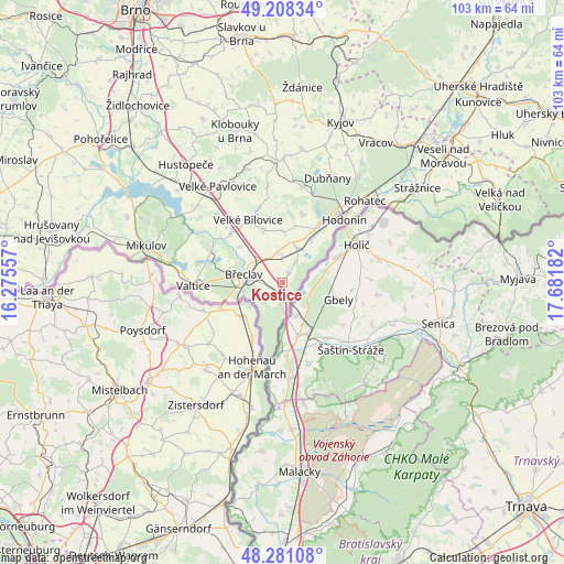
Kostice GPS coordinates[2]
48° 44' 48.66" North, 16° 58' 43.284" East
| Map corner | latitude | longitude |
|---|---|---|
| Upper-left | 49.20834°, | 16.27557° |
| Center: | 48.74685°, | 16.97869° |
| Lower-right: | 48.28108°, | 17.68182° |
| Map W x H: | 103.1×103.1 km | = 64.1×64.1mi |
| max Lat: | 51.01104° ⇑99.5% North |
| Kostice: | 48.74685° |
| min Lat: | ⇓0.5% South 48.60378° |
| min Long | Kostice | max Long |
| 12.17577° | 16.97869° | 18.82683° |
| W 75.3%⇐ | ⇒24.7% E |
Elevation
Elevation of Kostice is 167 m = 548 ft, and this is 185 m = 607 ft below average elevation for this country.
| Max E: |
901 m = 2956 ft | 98.6% |
| Avg. | 352 m = 1155 ft | |
| Kostice | 167 m = 548 ft | |
Min E: |
136 m = 446 ft | 1.4% |
See also: Czech Republic elevation on elevation.city.
Geographical zone
Kostice is located in North temperate zone (between Tropic of Cancer and the Arctic Circle). Distance of this North polar circle is 1981 km =1230.9 mi to North.| Distance of | km | miles | from Kostice |
|---|---|---|---|
| North Pole | 4586.9 | 2850.2 | to North |
| Arctic Circle | 1981 | 1230.9 | to North |
| Tropic Cancer | 2814.2 | 1748.7 | to South |
| Equator | 5420.1 | 3367.9 | to South |


Nearby cities:
15 places around Kostice: (largest is in red/bold)
• Břeclav
7.2 km =4.5 mi,  280°
280°
• Dolní Bojanovice
13 km =8.1 mi,  16°
16°
• Hrušky
5.1 km =3.2 mi,  356°
356°
• Lanžhot
2.6 km =1.6 mi,  199°
199°
• Lednice
14.1 km =8.8 mi,  294°
294°
• Lužice
12.5 km =7.8 mi,  32°
32°
• Mikulčice
9.4 km =5.8 mi, 34°
• Moravská Nová Ves
6.8 km =4.2 mi, 22°
• Moravský Žižkov
10.2 km =6.3 mi,  340°
340°
• Podivín
13 km =8.1 mi,  312°
312°
• Prušánky
9.1 km =5.7 mi,  0°
0°
• Starý Poddvorov
14.2 km =8.8 mi, 2°
• Tvrdonice
1.9 km =1.2 mi,  37°
37°
• Týnec
4.4 km =2.7 mi, 34°
• Velké Bílovice
13 km =8.1 mi,  330°
330°
Sources, notices
• [Note1] Compared only with cities in Czech Republic existing in our database
• [Src1] Map data: © OpenStreetMap contributors (CC-BY-SA)
• [Src2] Other city data from geonames.org with taken over terms of usage.
• [Src3] Geographical zone / Annual Mean Temperature by Robert A. Rohde @ Wikipedia
