Kostelany nad Moravou geodata
Kostelany nad Moravou (Zlín) is a populated place; located in Czech Republic in Europe/Prague (GMT+2) time zone. With population of 884 people, there are 1446 cities with bigger population in this country. Compared to other cities in Czech Republic, 89.5% of cities are located further ↑North; 83.6% of cities are located further ←West and 97.5% of cities have higher elevation than Kostelany nad Moravou. Note1
Administrative division(s):
- Level 1: Zlín
- Level 2: Okres Uherské Hradiště
- Level 3: Kostelany nad Moravou
Current local time in Kostelany nad Moravou:
05:45 AM, SaturdayDifference from your time zone: hours


Kostelany nad Moravou GPS coordinates[2]
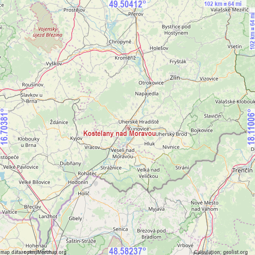
49° 2' 43.368" North, 17° 24' 24.948" East
| Map corner | latitude | longitude |
|---|---|---|
| Upper-left | 49.50412°, | 16.70381° |
| Center: | 49.04538°, | 17.40693° |
| Lower-right: | 48.58237°, | 18.11006° |
| Map W x H: | 102.5×102.5 km | = 63.7×63.7mi |
| max Lat: | 51.01104° ⇑89.5% North |
| Kostelany nad Moravou: | 49.04538° |
| min Lat: | ⇓10.5% South 48.60378° |
| min Long | Kostelany nad M | max Long |
| 12.17577° | 17.40693° | 18.82683° |
| W 83.6%⇐ | ⇒16.4% E |
Elevation
Elevation of Kostelany nad Moravou is 176 m = 577 ft, and this is 176 m = 577 ft below average elevation for this country.
| Max E: |
901 m = 2956 ft | 97.5% |
| Avg. | 352 m = 1155 ft | |
| Kostelany nad Moravou | 176 m = 577 ft | |
Min E: |
136 m = 446 ft | 2.5% |
See also: Czech Republic elevation on elevation.city.
Geographical zone
Kostelany nad Moravou is located in North temperate zone (between Tropic of Cancer and the Arctic Circle). Distance of this North polar circle is 1947.8 km =1210.3 mi to North.| Distance of | km | miles | from Kostelany nad Moravou |
|---|---|---|---|
| North Pole | 4553.7 | 2829.5 | to North |
| Arctic Circle | 1947.8 | 1210.3 | to North |
| Tropic Cancer | 2847.4 | 1769.3 | to South |
| Equator | 5453.3 | 3388.5 | to South |


Nearby cities:
15 places around Kostelany nad Moravou: (largest is in red/bold)
• Boršice
4.5 km =2.8 mi,  295°
295°
• Buchlovice
6.7 km =4.2 mi,  312°
312°
• Břestek
6.6 km =4.1 mi,  325°
325°
• Kunovice
4.6 km =2.9 mi,  90°
90°
• Modrá
7.4 km =4.6 mi,  358°
358°
• Nedakonice
2.4 km =1.5 mi,  230°
230°
• Ostrožská Nová Ves
5 km =3.1 mi,  154°
154°
• Ořechov
7.9 km =4.9 mi,  257°
257°
• Polešovice
5 km =3.1 mi, 255°
• Staré Město
3.8 km =2.4 mi,  30°
30°
• Tupesy
5.1 km =3.2 mi, 327°
• Uherské Hradiště
4.7 km =2.9 mi,  54°
54°
• Uherský Ostroh
6.8 km =4.2 mi,  190°
190°
• Velehrad
6.7 km =4.2 mi,  352°
352°
• Zlechov
3.8 km =2.4 mi, 327°
Sources, notices
• [Note1] Compared only with cities in Czech Republic existing in our database
• [Src1] Map data: © OpenStreetMap contributors (CC-BY-SA)
• [Src2] Other city data from geonames.org with taken over terms of usage.
• [Src3] Geographical zone / Annual Mean Temperature by Robert A. Rohde @ Wikipedia
