Jiřetín pod Bukovou geodata
Jiřetín pod Bukovou (Liberecký kraj) is a populated place; located in Czech Republic in Europe/Prague (GMT+2) time zone. With population of 646 people, there are 2005 cities with bigger population in this country. Compared to other cities in Czech Republic, 97.8% of cities are located further ↓South; 57.3% of cities are located further →East and 89.1% of cities have lower elevation than Jiřetín pod Bukovou. Note1
Administrative division(s):
- Level 1: Liberecký kraj
- Level 2: Okres Jablonec nad Nisou
- Level 3: Jiřetín pod Bukovou


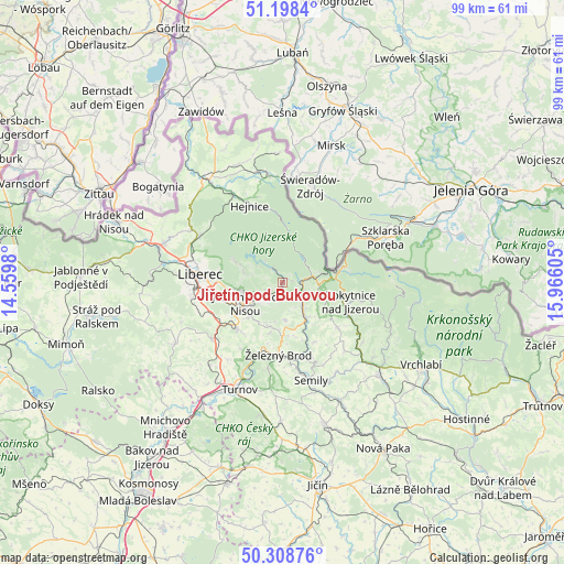
Jiřetín pod Bukovou GPS coordinates[2]
50° 45' 20.484" North, 15° 15' 46.512" East
| Map corner | latitude | longitude |
|---|---|---|
| Upper-left | 51.1984°, | 14.5598° |
| Center: | 50.75569°, | 15.26292° |
| Lower-right: | 50.30876°, | 15.96605° |
| Map W x H: | 98.9×98.9 km | = 61.5×61.5mi |
| max Lat: | 51.01104° ⇑2.2% North |
| Jiřetín pod Bukovou: | 50.75569° |
| min Lat: | ⇓97.8% South 48.60378° |
| min Long | Jiřetín pod B | max Long |
| 12.17577° | 15.26292° | 18.82683° |
| W 42.7%⇐ | ⇒57.3% E |
Elevation
Elevation of Jiřetín pod Bukovou is 524 m = 1719 ft, and this is 172 m = 564 ft above average elevation for this country.
| Max E: |
901 m = 2956 ft | 10.9% |
| Jiřetín pod Bukovou | 524 m 1719 ft | |
| Avg. | 352 m = 1155 ft | |
Min E: |
136 m = 446 ft | 89.1% |
See also: Czech Republic elevation on elevation.city.
Geographical zone
Jiřetín pod Bukovou is located in North temperate zone (between Tropic of Cancer and the Arctic Circle). Distance of this North polar circle is 1757.7 km =1092.2 mi to North.| Distance of | km | miles | from Jiřetín pod Bukovou |
|---|---|---|---|
| North Pole | 4363.6 | 2711.4 | to North |
| Arctic Circle | 1757.7 | 1092.2 | to North |
| Tropic Cancer | 3037.6 | 1887.5 | to South |
| Equator | 5643.5 | 3506.7 | to South |


Nearby cities:
15 places around Jiřetín pod Bukovou: (largest is in red/bold)
• Desná
2.8 km =1.7 mi,  80°
80°
• Držkov
8.1 km =5 mi,  159°
159°
• Jablonec nad Nisou
7.3 km =4.5 mi,  241°
241°
• Janov nad Nisou
6.8 km =4.2 mi,  285°
285°
• Josefův Důl
3.7 km =2.3 mi,  322°
322°
• Kořenov
7.2 km =4.5 mi,  86°
86°
• Lučany nad Nisou
3.4 km =2.1 mi, 241°
• Plavy
7 km =4.3 mi,  146°
146°
• Pěnčín
7.8 km =4.8 mi,  194°
194°
• Skuhrov
9.5 km =5.9 mi,  201°
201°
• Smržovka
2.3 km =1.4 mi,  210°
210°
• Tanvald
3.6 km =2.2 mi,  124°
124°
• Velké Hamry
5.9 km =3.7 mi,  141°
141°
• Zlatá Olešnice
8.3 km =5.2 mi,  129°
129°
• Zásada
6.5 km =4 mi,  175°
175°
Sources, notices
• [Note1] Compared only with cities in Czech Republic existing in our database
• [Src1] Map data: © OpenStreetMap contributors (CC-BY-SA)
• [Src2] Other city data from geonames.org with taken over terms of usage.
• [Src3] Geographical zone / Annual Mean Temperature by Robert A. Rohde @ Wikipedia
