Háj u Duchcova geodata
Háj u Duchcova (Ústecký kraj) is a populated place; located in Czech Republic in Europe/Prague (GMT+2) time zone. With population of 959 people, there are 1341 cities with bigger population in this country. Compared to other cities in Czech Republic, 94.7% of cities are located further ↓South; 88.9% of cities are located further →East and 63.2% of cities have higher elevation than Háj u Duchcova. Note1


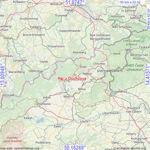
Háj u Duchcova GPS coordinates[2]
50° 37' 50.916" North, 13° 42' 45.288" East
| Map corner | latitude | longitude |
|---|---|---|
| Upper-left | 51.0747°, | 13.00946° |
| Center: | 50.63081°, | 13.71258° |
| Lower-right: | 50.18269°, | 14.41571° |
| Map W x H: | 99.2×99.2 km | = 61.6×61.6mi |
| max Lat: | 51.01104° ⇑5.3% North |
| Háj u Duchcova: | 50.63081° |
| min Lat: | ⇓94.7% South 48.60378° |
| min Long | Háj u Duchcova | max Long |
| 12.17577° | 13.71258° | 18.82683° |
| W 11.1%⇐ | ⇒88.9% E |
Elevation
Elevation of Háj u Duchcova is 280 m = 919 ft, and this is 72 m = 236 ft below average elevation for this country.
| Max E: |
901 m = 2956 ft | 63.2% |
| Avg. | 352 m = 1155 ft | |
| Háj u Duchcova | 280 m = 919 ft | |
Min E: |
136 m = 446 ft | 36.8% |
See also: Czech Republic elevation on elevation.city.
Geographical zone
Háj u Duchcova is located in North temperate zone (between Tropic of Cancer and the Arctic Circle). Distance of this North polar circle is 1771.6 km =1100.8 mi to North.| Distance of | km | miles | from Háj u Duchcova |
|---|---|---|---|
| North Pole | 4377.4 | 2720 | to North |
| Arctic Circle | 1771.6 | 1100.8 | to North |
| Tropic Cancer | 3023.7 | 1878.8 | to South |
| Equator | 5629.6 | 3498.1 | to South |


Nearby cities:
15 places around Háj u Duchcova: (largest is in red/bold)
• Dubí
8 km =5 mi,  40°
40°
• Duchcov
3.8 km =2.4 mi,  141°
141°
• Hrob
3.3 km =2.1 mi,  17°
17°
• Jeníkov
2.6 km =1.6 mi,  95°
95°
• Košťany
4.1 km =2.5 mi,  48°
48°
• Lahošt
4 km =2.5 mi,  110°
110°
• Ledvice
6.6 km =4.1 mi, 140°
• Litvínov
7.3 km =4.5 mi,  246°
246°
• Lom u Mostu
5.7 km =3.5 mi,  223°
223°
• Meziboři
8.1 km =5 mi,  262°
262°
• Novosedlice
8.3 km =5.2 mi,  69°
69°
• Osek
1.8 km =1.1 mi,  232°
232°
• Teplice
8 km =5 mi,  82°
82°
• Zabrušany
6 km =3.7 mi,  118°
118°
• Újezdeček
5.7 km =3.5 mi, 73°
Sources, notices
• [Note1] Compared only with cities in Czech Republic existing in our database
• [Src1] Map data: © OpenStreetMap contributors (CC-BY-SA)
• [Src2] Other city data from geonames.org with taken over terms of usage.
• [Src3] Geographical zone / Annual Mean Temperature by Robert A. Rohde @ Wikipedia
