Chrášťany geodata
Chrášťany (Jihočeský kraj) is a populated place; located in Czech Republic in Europe/Prague (GMT+2) time zone. With population of 710 people, there are 1809 cities with bigger population in this country. Compared to other cities in Czech Republic, 76.6% of cities are located further ↑North; 75% of cities are located further →East and 78.7% of cities have lower elevation than Chrášťany. Note1
Administrative division(s):
- Level 1: Jihočeský kraj
- Level 2: Okres České Budějovice
- Level 3: Chrášťany


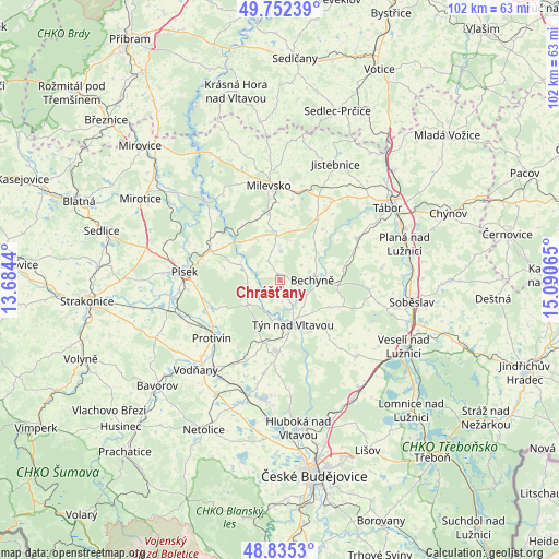
Chrášťany GPS coordinates[2]
49° 17' 45.528" North, 14° 23' 15.072" East
| Map corner | latitude | longitude |
|---|---|---|
| Upper-left | 49.75239°, | 13.6844° |
| Center: | 49.29598°, | 14.38752° |
| Lower-right: | 48.8353°, | 15.09065° |
| Map W x H: | 102×102 km | = 63.4×63.4mi |
| max Lat: | 51.01104° ⇑76.6% North |
| Chrášťany: | 49.29598° |
| min Lat: | ⇓23.4% South 48.60378° |
| min Long | Chrášťany | max Long |
| 12.17577° | 14.38752° | 18.82683° |
| W 25%⇐ | ⇒75% E |
Elevation
Elevation of Chrášťany is 457 m = 1499 ft, and this is 105 m = 344 ft above average elevation for this country.
| Max E: |
901 m = 2956 ft | 21.3% |
| Chrášťany | 457 m 1499 ft | |
| Avg. | 352 m = 1155 ft | |
Min E: |
136 m = 446 ft | 78.7% |
See also: Czech Republic elevation on elevation.city.
Geographical zone
Chrášťany is located in North temperate zone (between Tropic of Cancer and the Arctic Circle). Distance of this North polar circle is 1920 km =1193 mi to North.| Distance of | km | miles | from Chrášťany |
|---|---|---|---|
| North Pole | 4525.9 | 2812.3 | to North |
| Arctic Circle | 1920 | 1193 | to North |
| Tropic Cancer | 2875.3 | 1786.6 | to South |
| Equator | 5481.2 | 3405.9 | to South |


Nearby cities:
15 places around Chrášťany: (largest is in red/bold)
• Albrechtice nad Vltavou
7.8 km =4.8 mi,  232°
232°
• Bechyně
5.8 km =3.6 mi,  90°
90°
• Bernartice
8.1 km =5 mi,  356°
356°
• Dolní Záhoří
13.9 km =8.6 mi,  295°
295°
• Dřiteň
17.3 km =10.7 mi,  190°
190°
• Kluky
10.6 km =6.6 mi,  282°
282°
• Malšice
15.8 km =9.8 mi,  61°
61°
• Opařany
13.1 km =8.1 mi,  31°
31°
• Protivín
16.4 km =10.2 mi, 229°
• Sepekov
14.9 km =9.3 mi,  8°
8°
• Stádlec
12.1 km =7.5 mi,  39°
39°
• Temelín
11.8 km =7.3 mi, 193°
• Týn nad Vltavou
8.4 km =5.2 mi,  163°
163°
• Všemyslice
9 km =5.6 mi, 193°
• Žimutice
13.6 km =8.5 mi,  138°
138°
Sources, notices
• [Note1] Compared only with cities in Czech Republic existing in our database
• [Src1] Map data: © OpenStreetMap contributors (CC-BY-SA)
• [Src2] Other city data from geonames.org with taken over terms of usage.
• [Src3] Geographical zone / Annual Mean Temperature by Robert A. Rohde @ Wikipedia
