Cerekvice nad Loučnou geodata
Cerekvice nad Loučnou (Pardubický) is a populated place; located in Czech Republic in Europe/Prague (GMT+2) time zone. With population of 817 people, there are 1570 cities with bigger population in this country. Compared to other cities in Czech Republic, 58.4% of cities are located further ↓South; 59.1% of cities are located further ←West and 59.7% of cities have higher elevation than Cerekvice nad Loučnou. Note1
Administrative division(s):
- Level 1: Pardubický
- Level 2: Okres Svitavy
- Level 3: Cerekvice nad Loučnou
Current local time in Cerekvice nad Loučnou:
05:39 AM, SaturdayDifference from your time zone: hours


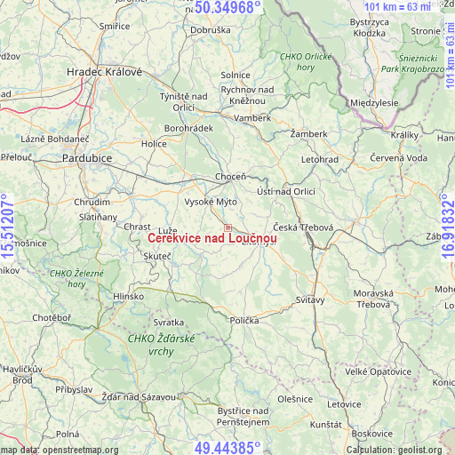
Cerekvice nad Loučnou GPS coordinates[2]
49° 53' 56.004" North, 16° 12' 54.684" East
| Map corner | latitude | longitude |
|---|---|---|
| Upper-left | 50.34968°, | 15.51207° |
| Center: | 49.89889°, | 16.21519° |
| Lower-right: | 49.44385°, | 16.91832° |
| Map W x H: | 100.7×100.7 km | = 62.6×62.6mi |
| max Lat: | 51.01104° ⇑41.6% North |
| Cerekvice nad Loučnou: | 49.89889° |
| min Lat: | ⇓58.4% South 48.60378° |
| min Long | Cerekvice nad L | max Long |
| 12.17577° | 16.21519° | 18.82683° |
| W 59.1%⇐ | ⇒40.9% E |
Elevation
Elevation of Cerekvice nad Loučnou is 294 m = 965 ft, and this is 58 m = 190 ft below average elevation for this country.
| Max E: |
901 m = 2956 ft | 59.7% |
| Avg. | 352 m = 1155 ft | |
| Cerekvice nad Loučnou | 294 m = 965 ft | |
Min E: |
136 m = 446 ft | 40.3% |
See also: Czech Republic elevation on elevation.city.
Geographical zone
Cerekvice nad Loučnou is located in North temperate zone (between Tropic of Cancer and the Arctic Circle). Distance of this North polar circle is 1852.9 km =1151.3 mi to North.| Distance of | km | miles | from Cerekvice nad Loučnou |
|---|---|---|---|
| North Pole | 4458.8 | 2770.6 | to North |
| Arctic Circle | 1852.9 | 1151.3 | to North |
| Tropic Cancer | 2942.3 | 1828.3 | to South |
| Equator | 5548.2 | 3447.5 | to South |


Nearby cities:
15 places around Cerekvice nad Loučnou: (largest is in red/bold)
• Brandýs nad Orlicí
12.5 km =7.8 mi,  23°
23°
• Choceň
11.4 km =7.1 mi,  2°
2°
• Dolní Sloupnice
6.5 km =4 mi,  60°
60°
• Dolní Újezd
8.6 km =5.3 mi,  160°
160°
• Horní Sloupnice
9.2 km =5.7 mi,  74°
74°
• Litomyšl
7.8 km =4.8 mi,  116°
116°
• Morašice
3.7 km =2.3 mi, 159°
• Němčice
9.2 km =5.7 mi,  95°
95°
• Osík
7.9 km =4.9 mi,  141°
141°
• Sruby
11.3 km =7 mi,  344°
344°
• Vraclav
11.8 km =7.3 mi,  310°
310°
• Vysoké Mýto
7.2 km =4.5 mi,  327°
327°
• Zámrsk
11.5 km =7.1 mi, 327°
• České Heřmanice
4.5 km =2.8 mi,  36°
36°
• Čistá
11.4 km =7.1 mi,  134°
134°
Sources, notices
• [Note1] Compared only with cities in Czech Republic existing in our database
• [Src1] Map data: © OpenStreetMap contributors (CC-BY-SA)
• [Src2] Other city data from geonames.org with taken over terms of usage.
• [Src3] Geographical zone / Annual Mean Temperature by Robert A. Rohde @ Wikipedia
