Častolovice geodata
Častolovice (Královéhradecký kraj) is a populated place; located in Czech Republic in Europe/Prague (GMT+2) time zone. With population of 1,614 people, there are 800 cities with bigger population in this country. Compared to other cities in Czech Republic, 73.8% of cities are located further ↓South; 58.5% of cities are located further ←West and 66.9% of cities have higher elevation than Častolovice. Note1
Administrative division(s):
- Level 1: Královéhradecký kraj
- Level 2: Okres Rychnov nad Kněžnou
- Level 3: Častolovice


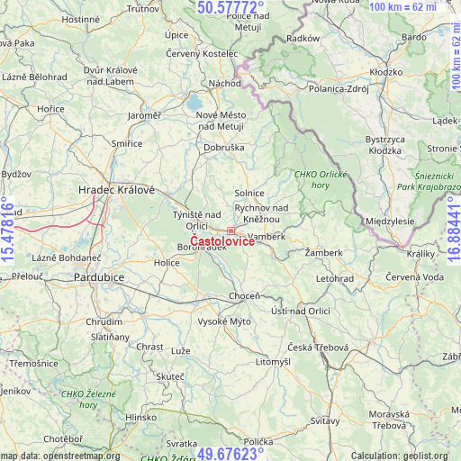
Častolovice GPS coordinates[2]
50° 7' 44.76" North, 16° 10' 52.608" East
| Map corner | latitude | longitude |
|---|---|---|
| Upper-left | 50.57772°, | 15.47816° |
| Center: | 50.1291°, | 16.18128° |
| Lower-right: | 49.67623°, | 16.88441° |
| Map W x H: | 100.2×100.2 km | = 62.3×62.3mi |
| max Lat: | 51.01104° ⇑26.2% North |
| Častolovice: | 50.1291° |
| min Lat: | ⇓73.8% South 48.60378° |
| min Long | Častolovice | max Long |
| 12.17577° | 16.18128° | 18.82683° |
| W 58.5%⇐ | ⇒41.5% E |
Elevation
Elevation of Častolovice is 266 m = 873 ft, and this is 86 m = 282 ft below average elevation for this country.
| Max E: |
901 m = 2956 ft | 66.9% |
| Avg. | 352 m = 1155 ft | |
| Častolovice | 266 m = 873 ft | |
Min E: |
136 m = 446 ft | 33.1% |
See also: Czech Republic elevation on elevation.city.
Geographical zone
Častolovice is located in North temperate zone (between Tropic of Cancer and the Arctic Circle). Distance of this North polar circle is 1827.3 km =1135.4 mi to North.| Distance of | km | miles | from Častolovice |
|---|---|---|---|
| North Pole | 4433.2 | 2754.7 | to North |
| Arctic Circle | 1827.3 | 1135.4 | to North |
| Tropic Cancer | 2967.9 | 1844.2 | to South |
| Equator | 5573.8 | 3463.4 | to South |


Nearby cities:
15 places around Častolovice: (largest is in red/bold)
• Albrechtice nad Orlicí
8.4 km =5.2 mi,  278°
278°
• Borohrádek
7.2 km =4.5 mi,  240°
240°
• Doudleby nad Orlicí
6.2 km =3.9 mi,  112°
112°
• Kostelec nad Orlicí
2.4 km =1.5 mi, 107°
• Kvasiny
11 km =6.8 mi,  32°
32°
• Lično
5.5 km =3.4 mi,  353°
353°
• Potštejn
10.5 km =6.5 mi,  119°
119°
• Rychnov nad Kněžnou
7.7 km =4.8 mi,  60°
60°
• Solnice
9.2 km =5.7 mi, 25°
• Týniště nad Orlicí
7.8 km =4.8 mi,  288°
288°
• Vamberk
7.9 km =4.9 mi,  99°
99°
• Voděrady
9.1 km =5.7 mi, 347°
• Záměl
9.1 km =5.7 mi, 113°
• Černíkovice
6.6 km =4.1 mi,  15°
15°
• Čestice
2.5 km =1.6 mi,  266°
266°
Sources, notices
• [Note1] Compared only with cities in Czech Republic existing in our database
• [Src1] Map data: © OpenStreetMap contributors (CC-BY-SA)
• [Src2] Other city data from geonames.org with taken over terms of usage.
• [Src3] Geographical zone / Annual Mean Temperature by Robert A. Rohde @ Wikipedia
