Benešov nad Černou geodata
Benešov nad Černou (Jihočeský kraj) is a populated place; located in Czech Republic in Europe/Prague (GMT+2) time zone. With population of 1,259 people, there are 1028 cities with bigger population in this country. Compared to other cities in Czech Republic, 99.6% of cities are located further ↑North; 68.5% of cities are located further →East and 97.8% of cities have lower elevation than Benešov nad Černou. Note1
Administrative division(s):
- Level 1: Jihočeský kraj
- Level 2: Okres Český Krumlov
- Level 3: Benešov nad Černou


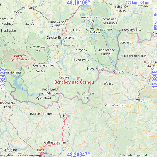
Benešov nad Černou GPS coordinates[2]
48° 43' 45.84" North, 14° 37' 38.532" East
| Map corner | latitude | longitude |
|---|---|---|
| Upper-left | 49.19106°, | 13.92425° |
| Center: | 48.7294°, | 14.62737° |
| Lower-right: | 48.26347°, | 15.3305° |
| Map W x H: | 103.1×103.1 km | = 64.1×64.1mi |
| max Lat: | 51.01104° ⇑99.6% North |
| Benešov nad Černou: | 48.7294° |
| min Lat: | ⇓0.4% South 48.60378° |
| min Long | Benešov nad Č | max Long |
| 12.17577° | 14.62737° | 18.82683° |
| W 31.5%⇐ | ⇒68.5% E |
Elevation
Elevation of Benešov nad Černou is 659 m = 2162 ft, and this is 307 m = 1007 ft above average elevation for this country.
| Max E: |
901 m = 2956 ft | 2.2% |
| Benešov nad Černou | 659 m 2162 ft | |
| Avg. | 352 m = 1155 ft | |
Min E: |
136 m = 446 ft | 97.8% |
See also: Czech Republic elevation on elevation.city.
Geographical zone
Benešov nad Černou is located in North temperate zone (between Tropic of Cancer and the Arctic Circle). Distance of this North polar circle is 1983 km =1232.2 mi to North.| Distance of | km | miles | from Benešov nad Černou |
|---|---|---|---|
| North Pole | 4588.9 | 2851.4 | to North |
| Arctic Circle | 1983 | 1232.2 | to North |
| Tropic Cancer | 2812.3 | 1747.5 | to South |
| Equator | 5418.2 | 3366.7 | to South |


Nearby cities:
15 places around Benešov nad Černou: (largest is in red/bold)
• Besednice
8.5 km =5.3 mi,  322°
322°
• Borovany
18.8 km =11.7 mi,  3°
3°
• Bujanov
14.8 km =9.2 mi,  258°
258°
• Dolní Dvořiště
15.2 km =9.4 mi,  237°
237°
• Horní Stropnice
8.7 km =5.4 mi,  65°
65°
• Kaplice
9.8 km =6.1 mi,  276°
276°
• Ločenice
12.8 km =8 mi,  325°
325°
• Malonty
6.1 km =3.8 mi,  217°
217°
• Nové Hrady
12.9 km =8 mi,  58°
58°
• Olešnice
13.7 km =8.5 mi,  24°
24°
• Sedlice
18 km =11.2 mi,  285°
285°
• Slavče
7.7 km =4.8 mi,  353°
353°
• Trhové Sviny
12.6 km =7.8 mi, 3°
• Velešín
16.4 km =10.2 mi,  312°
312°
• Římov
17.4 km =10.8 mi, 323°
Sources, notices
• [Note1] Compared only with cities in Czech Republic existing in our database
• [Src1] Map data: © OpenStreetMap contributors (CC-BY-SA)
• [Src2] Other city data from geonames.org with taken over terms of usage.
• [Src3] Geographical zone / Annual Mean Temperature by Robert A. Rohde @ Wikipedia
