Ziegenhain geodata
Ziegenhain (Rheinland-Pfalz) is a seat of a fourth-order administrative division; located in Germany in Europe/Berlin (GMT+2) time zone. With population of 135 people, there are 10739 cities with bigger population in this country. Compared to other cities in Germany, 51.6% of cities are located further ↓South; 86.4% of cities are located further →East and 57.6% of cities have lower elevation than Ziegenhain. Note1
Administrative division(s):
- Level 1: Rheinland-Pfalz
- Level 3: Landkreis Altenkirchen
- Level 4: Ziegenhain


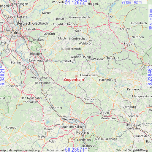
Ziegenhain GPS coordinates[2]
50° 40' 59.988" North, 7° 31' 59.988" East
| Map corner | latitude | longitude |
|---|---|---|
| Upper-left | 51.12672°, | 6.83021° |
| Center: | 50.68333°, | 7.53333° |
| Lower-right: | 50.23571°, | 8.23646° |
| Map W x H: | 99.1×99.1 km | = 61.6×61.6mi |
| max Lat: | 55.01917° ⇑48.4% North |
| Ziegenhain: | 50.68333° |
| min Lat: | ⇓51.6% South 47.40724° |
| min Long | Ziegenhain | max Long |
| 5.92978° | 7.53333° | 14.98853° |
| W 13.6%⇐ | ⇒86.4% E |
Elevation
Elevation of Ziegenhain is 276 m = 906 ft, and this is 26.9 m = 88 ft above average elevation for this country.
| Max E: |
1256 m = 4121 ft | 42.4% |
| Ziegenhain | 276 m 906 ft | |
| Avg. | 249.1 m = 817 ft | |
Min E: |
-5 m = -16 ft | 57.6% |
See also: Germany elevation on elevation.city.
Geographical zone
Ziegenhain is located in North temperate zone (between Tropic of Cancer and the Arctic Circle). Distance of this North polar circle is 1765.7 km =1097.2 mi to North.| Distance of | km | miles | from Ziegenhain |
|---|---|---|---|
| North Pole | 4371.6 | 2716.4 | to North |
| Arctic Circle | 1765.7 | 1097.2 | to North |
| Tropic Cancer | 3029.5 | 1882.4 | to South |
| Equator | 5635.5 | 3501.7 | to South |


Nearby cities:
15 places around Ziegenhain: (largest is in red/bold)
• Berzhausen
3 km =1.9 mi,  128°
128°
• Ersfeld
2.2 km =1.4 mi,  327°
327°
• Fiersbach
3 km =1.9 mi,  308°
308°
• Forstmehren
1.9 km =1.2 mi,  0°
0°
• Giershausen
0.9 km =0.6 mi,  105°
105°
• Hemmelzen
3.6 km =2.2 mi,  71°
71°
• Hirz-Maulsbach
3.5 km =2.2 mi,  270°
270°
• Kraam
1.9 km =1.2 mi, 0°
• Mehren
2.3 km =1.4 mi, 270°
• Obernau
3 km =1.9 mi, 128°
• Orfgen
1.9 km =1.2 mi,  180°
180°
• Rettersen
3 km =1.9 mi, 308°
• Schürdt
2.2 km =1.4 mi,  147°
147°
• Seifen
1.2 km =0.7 mi, 270°
• Walterschen
2.3 km =1.4 mi,  90°
90°
Sources, notices
• [Note1] Compared only with cities in Germany existing in our database
• [Src1] Map data: © OpenStreetMap contributors (CC-BY-SA)
• [Src2] Other city data from geonames.org with taken over terms of usage.
• [Src3] Geographical zone / Annual Mean Temperature by Robert A. Rohde @ Wikipedia
