Sörth geodata
Sörth (Rheinland-Pfalz) is a seat of a fourth-order administrative division; located in Germany in Europe/Berlin (GMT+2) time zone. With population of 238 people, there are 10312 cities with bigger population in this country. Compared to other cities in Germany, 52% of cities are located further ↓South; 83.4% of cities are located further →East and 56.3% of cities have lower elevation than Sörth. Note1


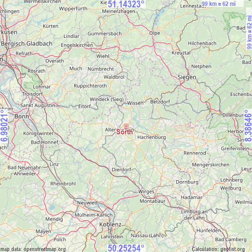
Sörth GPS coordinates[2]
50° 42' 0" North, 7° 40' 59.988" East
| Map corner | latitude | longitude |
|---|---|---|
| Upper-left | 51.14323°, | 6.98021° |
| Center: | 50.7°, | 7.68333° |
| Lower-right: | 50.25254°, | 8.38646° |
| Map W x H: | 99×99 km | = 61.5×61.5mi |
| max Lat: | 55.01917° ⇑48% North |
| Sörth: | 50.7° |
| min Lat: | ⇓52% South 47.40724° |
| min Long | Sörth | max Long |
| 5.92978° | 7.68333° | 14.98853° |
| W 16.6%⇐ | ⇒83.4% E |
Elevation
Elevation of Sörth is 268 m = 879 ft, and this is 18.9 m = 62 ft above average elevation for this country.
| Max E: |
1256 m = 4121 ft | 43.7% |
| Sörth | 268 m 879 ft | |
| Avg. | 249.1 m = 817 ft | |
Min E: |
-5 m = -16 ft | 56.3% |
See also: Germany elevation on elevation.city.
Geographical zone
Sörth is located in North temperate zone (between Tropic of Cancer and the Arctic Circle). Distance of this North polar circle is 1763.9 km =1096 mi to North.| Distance of | km | miles | from Sörth |
|---|---|---|---|
| North Pole | 4369.8 | 2715.3 | to North |
| Arctic Circle | 1763.9 | 1096 | to North |
| Tropic Cancer | 3031.4 | 1883.6 | to South |
| Equator | 5637.3 | 3502.9 | to South |


Nearby cities:
15 places around Sörth: (largest is in red/bold)
• Almersbach
4 km =2.5 mi,  242°
242°
• Altenkirchen
3.3 km =2.1 mi, 241°
• Bachenberg
3 km =1.9 mi,  308°
308°
• Eichelhardt
2.2 km =1.4 mi,  32°
32°
• Gieleroth
3.7 km =2.3 mi,  180°
180°
• Giesenhausen
2.3 km =1.4 mi,  90°
90°
• Idelberg
3 km =1.9 mi,  51°
51°
• Ingelbach
2.5 km =1.6 mi,  138°
138°
• Isert
3.9 km =2.4 mi,  17°
17°
• Kroppach
4 km =2.5 mi,  97°
97°
• Mammelzen
1.2 km =0.7 mi,  270°
270°
• Michelbach
2.2 km =1.4 mi,  212°
212°
• Obererbach
3.3 km =2.1 mi,  326°
326°
• Racksen
3.9 km =2.4 mi, 17°
• Volkerzen
1.9 km =1.2 mi,  0°
0°
Sources, notices
• [Note1] Compared only with cities in Germany existing in our database
• [Src1] Map data: © OpenStreetMap contributors (CC-BY-SA)
• [Src2] Other city data from geonames.org with taken over terms of usage.
• [Src3] Geographical zone / Annual Mean Temperature by Robert A. Rohde @ Wikipedia
