Relsberg geodata
Relsberg (Rheinland-Pfalz) is a seat of a fourth-order administrative division; located in Germany in Europe/Berlin (GMT+2) time zone. With population of 214 people, there are 10408 cities with bigger population in this country. Compared to other cities in Germany, 73.8% of cities are located further ↑North; 83.7% of cities are located further →East and 70.9% of cities have lower elevation than Relsberg. Note1


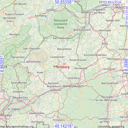
Relsberg GPS coordinates[2]
49° 36' 0" North, 7° 40' 0.012" East
| Map corner | latitude | longitude |
|---|---|---|
| Upper-left | 50.05358°, | 6.96355° |
| Center: | 49.6°, | 7.66667° |
| Lower-right: | 49.14216°, | 8.3698° |
| Map W x H: | 101.3×101.3 km | = 62.9×62.9mi |
| max Lat: | 55.01917° ⇑73.8% North |
| Relsberg: | 49.6° |
| min Lat: | ⇓26.2% South 47.40724° |
| min Long | Relsberg | max Long |
| 5.92978° | 7.66667° | 14.98853° |
| W 16.3%⇐ | ⇒83.7% E |
Elevation
Elevation of Relsberg is 365 m = 1198 ft, and this is 115.9 m = 380 ft above average elevation for this country.
| Max E: |
1256 m = 4121 ft | 29.1% |
| Relsberg | 365 m 1198 ft | |
| Avg. | 249.1 m = 817 ft | |
Min E: |
-5 m = -16 ft | 70.9% |
See also: Germany elevation on elevation.city.
Geographical zone
Relsberg is located in North temperate zone (between Tropic of Cancer and the Arctic Circle). Distance of this North polar circle is 1886.2 km =1172 mi to North.| Distance of | km | miles | from Relsberg |
|---|---|---|---|
| North Pole | 4492.1 | 2791.3 | to North |
| Arctic Circle | 1886.2 | 1172 | to North |
| Tropic Cancer | 2909.1 | 1807.6 | to South |
| Equator | 5515 | 3426.9 | to South |


Nearby cities:
15 places around Relsberg: (largest is in red/bold)
• Aschbach
6 km =3.7 mi,  270°
270°
• Becherbach
5.7 km =3.5 mi,  12°
12°
• Einöllen
3 km =1.9 mi,  307°
307°
• Ginsweiler
5.7 km =3.5 mi,  347°
347°
• Hefersweiler
1.2 km =0.7 mi,  90°
90°
• Hohenöllen
3 km =1.9 mi, 307°
• Niederkirchen
3 km =1.9 mi,  127°
127°
• Nußbach
4.4 km =2.7 mi,  32°
32°
• Oberweiler-Tiefenbach
3.6 km =2.2 mi, 270°
• Rathskirchen
4.1 km =2.5 mi,  62°
62°
• Reichsthal
4.8 km =3 mi, 90°
• Reipoltskirchen
3.7 km =2.3 mi,  0°
0°
• Rutsweiler an der Lauter
5.2 km =3.2 mi,  224°
224°
• Seelen
3.6 km =2.2 mi, 90°
• Wolfstein
4.8 km =3 mi,  248°
248°
Sources, notices
• [Note1] Compared only with cities in Germany existing in our database
• [Src1] Map data: © OpenStreetMap contributors (CC-BY-SA)
• [Src2] Other city data from geonames.org with taken over terms of usage.
• [Src3] Geographical zone / Annual Mean Temperature by Robert A. Rohde @ Wikipedia
