Neustadt geodata
Neustadt (Hamburg) is a section of populated place; located in Germany in Europe/Berlin (GMT+2) time zone. With population of 11,856 people, there are 1384 cities with bigger population in this country. Compared to other cities in Germany, 86.3% of cities are located further ↓South; 50.1% of cities are located further →East and 94.3% of cities have higher elevation than Neustadt. Note1
Administrative division(s):
- Level 1: Hamburg
- Level 3: Hamburg, Freie und Hansestadt
- Level 4: Hamburg, Freie und Hansestadt


Neustadt GPS coordinates[2]
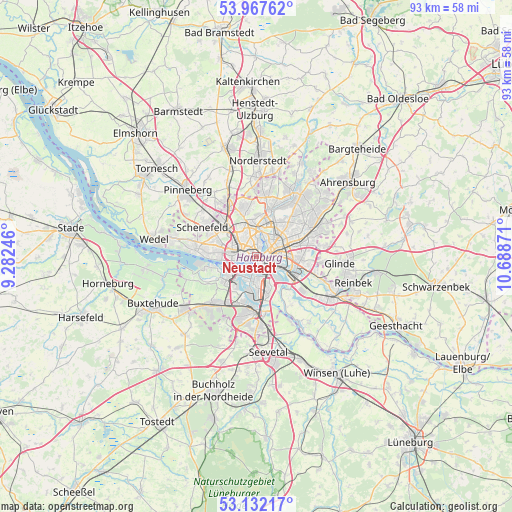
53° 33' 7.056" North, 9° 59' 8.088" East
| Map corner | latitude | longitude |
|---|---|---|
| Upper-left | 53.96762°, | 9.28246° |
| Center: | 53.55196°, | 9.98558° |
| Lower-right: | 53.13217°, | 10.68871° |
| Map W x H: | 92.9×92.9 km | = 57.7×57.7mi |
| max Lat: | 55.01917° ⇑13.7% North |
| Neustadt: | 53.55196° |
| min Lat: | ⇓86.3% South 47.40724° |
| min Long | Neustadt | max Long |
| 5.92978° | 9.98558° | 14.98853° |
| W 49.9%⇐ | ⇒50.1% E |
Elevation
Elevation of Neustadt is 10 m = 33 ft, and this is 239.1 m = 784 ft below average elevation for this country.
| Max E: |
1256 m = 4121 ft | 94.3% |
| Avg. | 249.1 m = 817 ft | |
| Neustadt | 10 m = 33 ft | |
Min E: |
-5 m = -16 ft | 5.7% |
See also: Germany elevation on elevation.city.
Geographical zone
Neustadt is located in North temperate zone (between Tropic of Cancer and the Arctic Circle). Distance of this North polar circle is 1446.8 km =899 mi to North.| Distance of | km | miles | from Neustadt |
|---|---|---|---|
| North Pole | 4052.6 | 2518.2 | to North |
| Arctic Circle | 1446.8 | 899 | to North |
| Tropic Cancer | 3348.5 | 2080.7 | to South |
| Equator | 5954.4 | 3699.9 | to South |


Nearby cities:
15 places around Neustadt: (largest is in red/bold)
• Altona
3.5 km =2.2 mi,  266°
266°
• Borgfelde
3.2 km =2 mi,  84°
84°
• Eimsbüttel
3.1 km =1.9 mi,  322°
322°
• Hamburg
3.3 km =2.1 mi,  37°
37°
• Hamburg-Altstadt
1 km =0.6 mi,  102°
102°
• Hamburg-Mitte
2.1 km =1.3 mi, 96°
• Hamburg-Nord
4.2 km =2.6 mi,  358°
358°
• Hammerbrook
3.1 km =1.9 mi, 104°
• Kleiner Grasbrook
2.4 km =1.5 mi,  167°
167°
• Ottensen
4.6 km =2.9 mi, 267°
• Rothenburgsort
4.1 km =2.5 mi,  117°
117°
• St. Georg
1.8 km =1.1 mi, 78°
• St. Pauli
1.5 km =0.9 mi,  291°
291°
• Stellingen
5.8 km =3.6 mi, 319°
• Winterhude
5.4 km =3.4 mi,  10°
10°
Sources, notices
• [Note1] Compared only with cities in Germany existing in our database
• [Src1] Map data: © OpenStreetMap contributors (CC-BY-SA)
• [Src2] Other city data from geonames.org with taken over terms of usage.
• [Src3] Geographical zone / Annual Mean Temperature by Robert A. Rohde @ Wikipedia
