Mühlenbarbek geodata
Mühlenbarbek (Schleswig-Holstein) is a seat of a fourth-order administrative division; located in Germany in Europe/Berlin (GMT+2) time zone. With population of 355 people, there are 9854 cities with bigger population in this country. Compared to other cities in Germany, 92.2% of cities are located further ↓South; 54.8% of cities are located further →East and 96.2% of cities have higher elevation than Mühlenbarbek. Note1
Administrative division(s):
- Level 1: Schleswig-Holstein
- Level 3: Kreis Steinburg
- Level 4: Mühlenbarbek


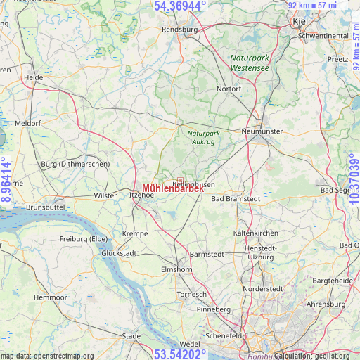
Mühlenbarbek GPS coordinates[2]
53° 57' 28.008" North, 9° 40' 2.136" East
| Map corner | latitude | longitude |
|---|---|---|
| Upper-left | 54.36944°, | 8.96414° |
| Center: | 53.95778°, | 9.66726° |
| Lower-right: | 53.54202°, | 10.37039° |
| Map W x H: | 92×92 km | = 57.2×57.2mi |
| max Lat: | 55.01917° ⇑7.8% North |
| Mühlenbarbek: | 53.95778° |
| min Lat: | ⇓92.2% South 47.40724° |
| min Long | Mühlenbarbek | max Long |
| 5.92978° | 9.66726° | 14.98853° |
| W 45.2%⇐ | ⇒54.8% E |
Elevation
Elevation of Mühlenbarbek is 6 m = 20 ft, and this is 243.1 m = 798 ft below average elevation for this country.
| Max E: |
1256 m = 4121 ft | 96.2% |
| Avg. | 249.1 m = 817 ft | |
| Mühlenbarbek | 6 m = 20 ft | |
Min E: |
-5 m = -16 ft | 3.8% |
See also: Germany elevation on elevation.city.
Geographical zone
Mühlenbarbek is located in North temperate zone (between Tropic of Cancer and the Arctic Circle). Distance of this North polar circle is 1401.6 km =870.9 mi to North.| Distance of | km | miles | from Mühlenbarbek |
|---|---|---|---|
| North Pole | 4007.5 | 2490.1 | to North |
| Arctic Circle | 1401.6 | 870.9 | to North |
| Tropic Cancer | 3393.6 | 2108.7 | to South |
| Equator | 5999.5 | 3727.9 | to South |


Nearby cities:
15 places around Mühlenbarbek: (largest is in red/bold)
• Auufer
3.9 km =2.4 mi,  164°
164°
• Breitenberg
4.3 km =2.7 mi,  209°
209°
• Hohenlockstedt
3.5 km =2.2 mi,  286°
286°
• Kellinghusen
3.5 km =2.2 mi,  100°
100°
• Lockstedt
4.8 km =3 mi,  12°
12°
• Lohbarbek
2.5 km =1.6 mi,  236°
236°
• Moordiek
4.9 km =3 mi,  190°
190°
• Oeschebüttel
5 km =3.1 mi,  45°
45°
• Rosdorf
4.5 km =2.8 mi,  60°
60°
• Schlotfeld
5.6 km =3.5 mi,  268°
268°
• Störkathen
6.1 km =3.8 mi, 62°
• Westermoor
5.7 km =3.5 mi, 209°
• Winseldorf
4.3 km =2.7 mi,  249°
249°
• Wittenbergen
3 km =1.9 mi, 155°
• Wulfsmoor
6.3 km =3.9 mi,  143°
143°
Sources, notices
• [Note1] Compared only with cities in Germany existing in our database
• [Src1] Map data: © OpenStreetMap contributors (CC-BY-SA)
• [Src2] Other city data from geonames.org with taken over terms of usage.
• [Src3] Geographical zone / Annual Mean Temperature by Robert A. Rohde @ Wikipedia
