Haby geodata
Haby (Schleswig-Holstein) is a seat of a fourth-order administrative division; located in Germany in Europe/Berlin (GMT+2) time zone. With population of 608 people, there are 8774 cities with bigger population in this country. Compared to other cities in Germany, 97.4% of cities are located further ↓South; 52.6% of cities are located further →East and 87.3% of cities have higher elevation than Haby. Note1
Administrative division(s):
- Level 1: Schleswig-Holstein
- Level 3: Kreis Rendsburg-Eckernförde
- Level 4: Haby


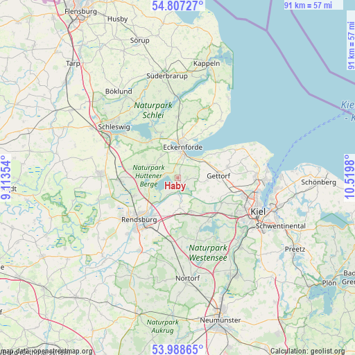
Haby GPS coordinates[2]
54° 24' 0" North, 9° 49' 0.012" East
| Map corner | latitude | longitude |
|---|---|---|
| Upper-left | 54.80727°, | 9.11354° |
| Center: | 54.4°, | 9.81667° |
| Lower-right: | 53.98865°, | 10.5198° |
| Map W x H: | 91×91 km | = 56.5×56.5mi |
| max Lat: | 55.01917° ⇑2.6% North |
| Haby: | 54.4° |
| min Lat: | ⇓97.4% South 47.40724° |
| min Long | Haby | max Long |
| 5.92978° | 9.81667° | 14.98853° |
| W 47.4%⇐ | ⇒52.6% E |
Elevation
Elevation of Haby is 29 m = 95 ft, and this is 220.1 m = 722 ft below average elevation for this country.
| Max E: |
1256 m = 4121 ft | 87.3% |
| Avg. | 249.1 m = 817 ft | |
| Haby | 29 m = 95 ft | |
Min E: |
-5 m = -16 ft | 12.7% |
See also: Germany elevation on elevation.city.
Geographical zone
Haby is located in North temperate zone (between Tropic of Cancer and the Arctic Circle). Distance of this North polar circle is 1352.5 km =840.4 mi to North.| Distance of | km | miles | from Haby |
|---|---|---|---|
| North Pole | 3958.3 | 2459.6 | to North |
| Arctic Circle | 1352.5 | 840.4 | to North |
| Tropic Cancer | 3442.8 | 2139.3 | to South |
| Equator | 6048.7 | 3758.5 | to South |


Nearby cities:
15 places around Haby: (largest is in red/bold)
• Altenhof
4.9 km =3 mi,  41°
41°
• Bovenau
7.5 km =4.7 mi,  171°
171°
• Bünsdorf
5.7 km =3.5 mi,  229°
229°
• Damendorf
5.7 km =3.5 mi,  288°
288°
• Eckernförde
7.7 km =4.8 mi,  10°
10°
• Goosefeld
3.7 km =2.3 mi,  0°
0°
• Groß Wittensee
3.2 km =2 mi,  270°
270°
• Holtsee
2.2 km =1.4 mi,  90°
90°
• Holzbunge
7.8 km =4.8 mi,  256°
256°
• Hütten
7.5 km =4.7 mi,  299°
299°
• Klein Wittensee
5.7 km =3.5 mi,  251°
251°
• Lindau
5.7 km =3.5 mi,  108°
108°
• Osterby
7 km =4.3 mi,  322°
322°
• Sehestedt
3.7 km =2.3 mi,  180°
180°
• Windeby
7.4 km =4.6 mi, 0°
Sources, notices
• [Note1] Compared only with cities in Germany existing in our database
• [Src1] Map data: © OpenStreetMap contributors (CC-BY-SA)
• [Src2] Other city data from geonames.org with taken over terms of usage.
• [Src3] Geographical zone / Annual Mean Temperature by Robert A. Rohde @ Wikipedia
