Ernzen geodata
Ernzen (Rheinland-Pfalz) is a seat of a fourth-order administrative division; located in Germany in Europe/Berlin (GMT+2) time zone. With population of 435 people, there are 9583 cities with bigger population in this country. Compared to other cities in Germany, 67.9% of cities are located further ↑North; 98.4% of cities are located further →East and 62.9% of cities have lower elevation than Ernzen. Note1
Administrative division(s):
- Level 1: Rheinland-Pfalz
- Level 3: Eifelkreis Bitburg-Prüm
- Level 4: Ernzen


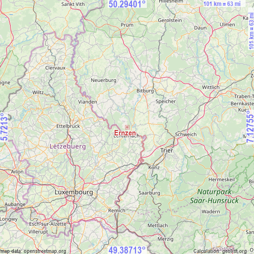
Ernzen GPS coordinates[2]
49° 50' 33.72" North, 6° 25' 27.912" East
| Map corner | latitude | longitude |
|---|---|---|
| Upper-left | 50.29401°, | 5.7213° |
| Center: | 49.8427°, | 6.42442° |
| Lower-right: | 49.38713°, | 7.12755° |
| Map W x H: | 100.8×100.8 km | = 62.6×62.6mi |
| max Lat: | 55.01917° ⇑67.9% North |
| Ernzen: | 49.8427° |
| min Lat: | ⇓32.1% South 47.40724° |
| min Long | Ernzen | max Long |
| 5.92978° | 6.42442° | 14.98853° |
| W 1.6%⇐ | ⇒98.4% E |
Elevation
Elevation of Ernzen is 308 m = 1010 ft, and this is 58.9 m = 193 ft above average elevation for this country.
| Max E: |
1256 m = 4121 ft | 37.1% |
| Ernzen | 308 m 1010 ft | |
| Avg. | 249.1 m = 817 ft | |
Min E: |
-5 m = -16 ft | 62.9% |
See also: Germany elevation on elevation.city.
Geographical zone
Ernzen is located in North temperate zone (between Tropic of Cancer and the Arctic Circle). Distance of this North polar circle is 1859.2 km =1155.3 mi to North.| Distance of | km | miles | from Ernzen |
|---|---|---|---|
| North Pole | 4465.1 | 2774.5 | to North |
| Arctic Circle | 1859.2 | 1155.3 | to North |
| Tropic Cancer | 2936.1 | 1824.4 | to South |
| Equator | 5542 | 3443.6 | to South |


Nearby cities:
15 places around Ernzen: (largest is in red/bold)
• Alsdorf
6 km =3.7 mi,  31°
31°
• Bollendorf
4.9 km =3 mi,  283°
283°
• Echternacherbrück
3 km =1.9 mi,  167°
167°
• Eisenach
6.7 km =4.2 mi,  83°
83°
• Ferschweiler
3.2 km =2 mi,  326°
326°
• Holsthum
5.7 km =3.5 mi,  351°
351°
• Irrel
2.4 km =1.5 mi, 82°
• Kaschenbach
5.4 km =3.4 mi,  46°
46°
• Menningen
4.4 km =2.7 mi,  103°
103°
• Minden
3.2 km =2 mi,  108°
108°
• Niederweis
4.3 km =2.7 mi, 45°
• Peffingen
6.6 km =4.1 mi,  344°
344°
• Prümzurlay
2.7 km =1.7 mi,  13°
13°
• Ralingen
6.1 km =3.8 mi,  118°
118°
• Schankweiler
7 km =4.3 mi, 335°
Sources, notices
• [Note1] Compared only with cities in Germany existing in our database
• [Src1] Map data: © OpenStreetMap contributors (CC-BY-SA)
• [Src2] Other city data from geonames.org with taken over terms of usage.
• [Src3] Geographical zone / Annual Mean Temperature by Robert A. Rohde @ Wikipedia
