Dillendorf geodata
Dillendorf (Rheinland-Pfalz) is a seat of a fourth-order administrative division; located in Germany in Europe/Berlin (GMT+2) time zone. With population of 604 people, there are 8791 cities with bigger population in this country. Compared to other cities in Germany, 66% of cities are located further ↑North; 88.8% of cities are located further →East and 68.3% of cities have lower elevation than Dillendorf. Note1
Administrative division(s):
- Level 1: Rheinland-Pfalz
- Level 3: Rhein-Hunsrück-Kreis
- Level 4: Dillendorf


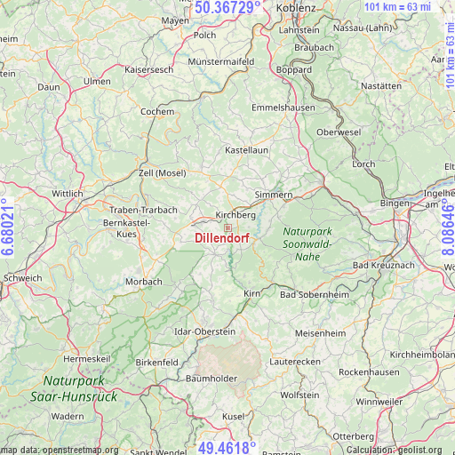
Dillendorf GPS coordinates[2]
49° 55' 0.012" North, 7° 22' 59.988" East
| Map corner | latitude | longitude |
|---|---|---|
| Upper-left | 50.36729°, | 6.68021° |
| Center: | 49.91667°, | 7.38333° |
| Lower-right: | 49.4618°, | 8.08646° |
| Map W x H: | 100.7×100.7 km | = 62.6×62.6mi |
| max Lat: | 55.01917° ⇑66% North |
| Dillendorf: | 49.91667° |
| min Lat: | ⇓34% South 47.40724° |
| min Long | Dillendorf | max Long |
| 5.92978° | 7.38333° | 14.98853° |
| W 11.2%⇐ | ⇒88.8% E |
Elevation
Elevation of Dillendorf is 345 m = 1132 ft, and this is 95.9 m = 315 ft above average elevation for this country.
| Max E: |
1256 m = 4121 ft | 31.7% |
| Dillendorf | 345 m 1132 ft | |
| Avg. | 249.1 m = 817 ft | |
Min E: |
-5 m = -16 ft | 68.3% |
See also: Germany elevation on elevation.city.
Geographical zone
Dillendorf is located in North temperate zone (between Tropic of Cancer and the Arctic Circle). Distance of this North polar circle is 1851 km =1150.2 mi to North.| Distance of | km | miles | from Dillendorf |
|---|---|---|---|
| North Pole | 4456.8 | 2769.3 | to North |
| Arctic Circle | 1851 | 1150.2 | to North |
| Tropic Cancer | 2944.3 | 1829.5 | to South |
| Equator | 5550.2 | 3448.7 | to South |


Nearby cities:
15 places around Dillendorf: (largest is in red/bold)
• Dickenschied
3 km =1.9 mi,  127°
127°
• Dill
2.4 km =1.5 mi,  270°
270°
• Hecken
1.2 km =0.7 mi,  90°
90°
• Kirchberg
3.5 km =2.2 mi,  29°
29°
• Lindenschied
2.2 km =1.4 mi,  147°
147°
• Maitzborn
4 km =2.5 mi,  62°
62°
• Nieder Kostenz
3.9 km =2.4 mi,  342°
342°
• Niedersohren
4 km =2.5 mi,  297°
297°
• Ober Kostenz
4.4 km =2.7 mi,  327°
327°
• Oberkirn
3.9 km =2.4 mi,  197°
197°
• Rohrbach
4.4 km =2.7 mi, 147°
• Schwerbach
3 km =1.9 mi,  232°
232°
• Sohren
5.1 km =3.2 mi,  291°
291°
• Sohrschied
3 km =1.9 mi, 232°
• Womrath
4.8 km =3 mi, 90°
Sources, notices
• [Note1] Compared only with cities in Germany existing in our database
• [Src1] Map data: © OpenStreetMap contributors (CC-BY-SA)
• [Src2] Other city data from geonames.org with taken over terms of usage.
• [Src3] Geographical zone / Annual Mean Temperature by Robert A. Rohde @ Wikipedia
