Breitscheidt geodata
Breitscheidt (Rheinland-Pfalz) is a seat of a fourth-order administrative division; located in Germany in Europe/Berlin (GMT+2) time zone. With population of 1,041 people, there are 7046 cities with bigger population in this country. Compared to other cities in Germany, 53.2% of cities are located further ↓South; 84% of cities are located further →East and 51.7% of cities have lower elevation than Breitscheidt. Note1
Administrative division(s):
- Level 1: Rheinland-Pfalz
- Level 3: Landkreis Altenkirchen
- Level 4: Breitscheidt


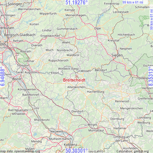
Breitscheidt GPS coordinates[2]
50° 45' 0" North, 7° 39' 0" East
| Map corner | latitude | longitude |
|---|---|---|
| Upper-left | 51.19276°, | 6.94688° |
| Center: | 50.75°, | 7.65° |
| Lower-right: | 50.30301°, | 8.35313° |
| Map W x H: | 98.9×98.9 km | = 61.5×61.5mi |
| max Lat: | 55.01917° ⇑46.8% North |
| Breitscheidt: | 50.75° |
| min Lat: | ⇓53.2% South 47.40724° |
| min Long | Breitscheidt | max Long |
| 5.92978° | 7.65° | 14.98853° |
| W 16%⇐ | ⇒84% E |
Elevation
Elevation of Breitscheidt is 238 m = 781 ft, and this is 11.1 m = 36 ft below average elevation for this country.
| Max E: |
1256 m = 4121 ft | 48.3% |
| Avg. | 249.1 m = 817 ft | |
| Breitscheidt | 238 m = 781 ft | |
Min E: |
-5 m = -16 ft | 51.7% |
See also: Germany elevation on elevation.city.
Geographical zone
Breitscheidt is located in North temperate zone (between Tropic of Cancer and the Arctic Circle). Distance of this North polar circle is 1758.3 km =1092.6 mi to North.| Distance of | km | miles | from Breitscheidt |
|---|---|---|---|
| North Pole | 4364.2 | 2711.8 | to North |
| Arctic Circle | 1758.3 | 1092.6 | to North |
| Tropic Cancer | 3037 | 1887.1 | to South |
| Equator | 5642.9 | 3506.3 | to South |


Nearby cities:
15 places around Breitscheidt: (largest is in red/bold)
• Bachenberg
3.7 km =2.3 mi,  180°
180°
• Birkenbeul
3 km =1.9 mi,  231°
231°
• Busenhausen
3.9 km =2.4 mi,  197°
197°
• Etzbach
4.1 km =2.5 mi,  40°
40°
• Fürthen
3.9 km =2.4 mi,  17°
17°
• Hamm
2.6 km =1.6 mi,  48°
48°
• Hilgenroth
1.9 km =1.2 mi, 180°
• Isert
4 km =2.5 mi,  117°
117°
• Kettenhausen
3.9 km =2.4 mi, 197°
• Niederirsen
3.5 km =2.2 mi,  270°
270°
• Obererbach
2.9 km =1.8 mi,  169°
169°
• Pracht
1.1 km =0.7 mi,  355°
355°
• Racksen
4 km =2.5 mi, 117°
• Roth
3.8 km =2.4 mi,  68°
68°
• Ölsen
4 km =2.5 mi,  242°
242°
Sources, notices
• [Note1] Compared only with cities in Germany existing in our database
• [Src1] Map data: © OpenStreetMap contributors (CC-BY-SA)
• [Src2] Other city data from geonames.org with taken over terms of usage.
• [Src3] Geographical zone / Annual Mean Temperature by Robert A. Rohde @ Wikipedia
