Hinzert-Pölert geodata
Hinzert-Pölert (Rheinland-Pfalz) is a seat of a fourth-order administrative division; located in Germany in Europe/Berlin (GMT+2) time zone. With population of 277 people, there are 10143 cities with bigger population in this country. Compared to other cities in Germany, 71.5% of cities are located further ↑North; 94.5% of cities are located further →East and 88.9% of cities have lower elevation than Hinzert-Pölert. Note1
Administrative division(s):
- Level 1: Rheinland-Pfalz
- Level 3: Landkreis Trier-Saarburg
- Level 4: Hinzert-Pölert


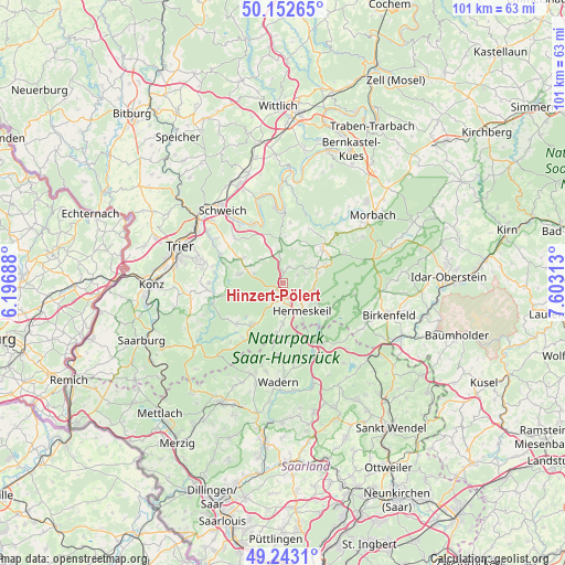
Hinzert-Pölert GPS coordinates[2]
49° 42' 0" North, 6° 54' 0" East
| Map corner | latitude | longitude |
|---|---|---|
| Upper-left | 50.15265°, | 6.19688° |
| Center: | 49.7°, | 6.9° |
| Lower-right: | 49.2431°, | 7.60313° |
| Map W x H: | 101.1×101.1 km | = 62.8×62.8mi |
| max Lat: | 55.01917° ⇑71.5% North |
| Hinzert-Pölert: | 49.7° |
| min Lat: | ⇓28.5% South 47.40724° |
| min Long | Hinzert-Pölert | max Long |
| 5.92978° | 6.9° | 14.98853° |
| W 5.5%⇐ | ⇒94.5% E |
Elevation
Elevation of Hinzert-Pölert is 503 m = 1650 ft, and this is 253.9 m = 833 ft above average elevation for this country.
| Max E: |
1256 m = 4121 ft | 11.1% |
| Hinzert-Pölert | 503 m 1650 ft | |
| Avg. | 249.1 m = 817 ft | |
Min E: |
-5 m = -16 ft | 88.9% |
See also: Germany elevation on elevation.city.
Geographical zone
Hinzert-Pölert is located in North temperate zone (between Tropic of Cancer and the Arctic Circle). Distance of this North polar circle is 1875.1 km =1165.1 mi to North.| Distance of | km | miles | from Hinzert-Pölert |
|---|---|---|---|
| North Pole | 4480.9 | 2784.3 | to North |
| Arctic Circle | 1875.1 | 1165.1 | to North |
| Tropic Cancer | 2920.2 | 1814.5 | to South |
| Equator | 5526.1 | 3433.8 | to South |


Nearby cities:
15 places around Hinzert-Pölert: (largest is in red/bold)
• Bescheid
5.7 km =3.5 mi,  347°
347°
• Beuren
3.3 km =2.1 mi,  20°
20°
• Burtscheid
5.2 km =3.2 mi,  44°
44°
• Damflos
7 km =4.3 mi,  121°
121°
• Dhronecken
6.3 km =3.9 mi,  72°
72°
• Farschweiler
6.3 km =3.9 mi,  287°
287°
• Geisfeld
4 km =2.5 mi,  62°
62°
• Herl
7 km =4.3 mi,  301°
301°
• Hermeskeil
5.9 km =3.7 mi,  147°
147°
• Lorscheid
5.2 km =3.2 mi,  315°
315°
• Lückenburg
6.1 km =3.8 mi,  52°
52°
• Malborn
6.3 km =3.9 mi, 72°
• Neunkirchen
6.6 km =4.1 mi,  32°
32°
• Rascheid
3 km =1.9 mi, 52°
• Reinsfeld
2.2 km =1.4 mi,  212°
212°
Sources, notices
• [Note1] Compared only with cities in Germany existing in our database
• [Src1] Map data: © OpenStreetMap contributors (CC-BY-SA)
• [Src2] Other city data from geonames.org with taken over terms of usage.
• [Src3] Geographical zone / Annual Mean Temperature by Robert A. Rohde @ Wikipedia
