Barmbek-Nord geodata
Barmbek-Nord (Hamburg) is a section of populated place; located in Germany in Europe/Berlin (GMT+2) time zone. With population of 40,261 people, there are 318 cities with bigger population in this country. Compared to other cities in Germany, 87% of cities are located further ↓South; 50.7% of cities are located further ←West and 90.5% of cities have higher elevation than Barmbek-Nord. Note1
Administrative division(s):
- Level 1: Hamburg
- Level 3: Hamburg, Freie und Hansestadt
- Level 4: Hamburg, Freie und Hansestadt


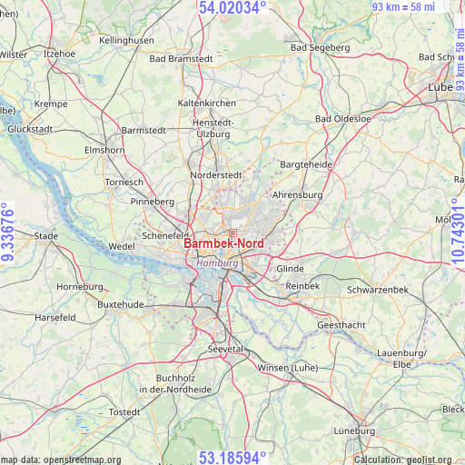
Barmbek-Nord GPS coordinates[2]
53° 36' 18.72" North, 10° 2' 23.568" East
| Map corner | latitude | longitude |
|---|---|---|
| Upper-left | 54.02034°, | 9.33676° |
| Center: | 53.6052°, | 10.03988° |
| Lower-right: | 53.18594°, | 10.74301° |
| Map W x H: | 92.8×92.8 km | = 57.7×57.7mi |
| max Lat: | 55.01917° ⇑13% North |
| Barmbek-Nord: | 53.6052° |
| min Lat: | ⇓87% South 47.40724° |
| min Long | Barmbek-Nord | max Long |
| 5.92978° | 10.03988° | 14.98853° |
| W 50.7%⇐ | ⇒49.3% E |
Elevation
Elevation of Barmbek-Nord is 20 m = 66 ft, and this is 229.1 m = 752 ft below average elevation for this country.
| Max E: |
1256 m = 4121 ft | 90.5% |
| Avg. | 249.1 m = 817 ft | |
| Barmbek-Nord | 20 m = 66 ft | |
Min E: |
-5 m = -16 ft | 9.5% |
See also: Barmbek-Nord elevation on elevation.city.
Geographical zone
Barmbek-Nord is located in North temperate zone (between Tropic of Cancer and the Arctic Circle). Distance of this North polar circle is 1440.8 km =895.3 mi to North.| Distance of | km | miles | from Barmbek-Nord |
|---|---|---|---|
| North Pole | 4046.7 | 2514.5 | to North |
| Arctic Circle | 1440.8 | 895.3 | to North |
| Tropic Cancer | 3354.4 | 2084.3 | to South |
| Equator | 5960.3 | 3703.6 | to South |


Nearby cities:
15 places around Barmbek-Nord: (largest is in red/bold)
• Alsterdorf
1.9 km =1.2 mi,  289°
289°
• Borgfelde
5.6 km =3.5 mi,  183°
183°
• Farmsen-Berne
5.3 km =3.3 mi,  88°
88°
• Fuhlsbüttel
3.6 km =2.2 mi,  334°
334°
• Hamburg
3.7 km =2.3 mi,  205°
205°
• Hamburg-Mitte
6.3 km =3.9 mi,  194°
194°
• Hamburg-Nord
4.1 km =2.5 mi,  244°
244°
• Hummelsbüttel
4.7 km =2.9 mi,  1°
1°
• Marienthal
5.2 km =3.2 mi,  146°
146°
• Ohlsdorf
2.4 km =1.5 mi,  346°
346°
• St. Georg
5.9 km =3.7 mi,  198°
198°
• Steilshoop
1.4 km =0.9 mi,  66°
66°
• Wandsbek
3.7 km =2.3 mi,  130°
130°
• Wellingsbüttel
4.8 km =3 mi,  33°
33°
• Winterhude
2.7 km =1.7 mi,  257°
257°
Sources, notices
• [Note1] Compared only with cities in Germany existing in our database
• [Src1] Map data: © OpenStreetMap contributors (CC-BY-SA)
• [Src2] Other city data from geonames.org with taken over terms of usage.
• [Src3] Geographical zone / Annual Mean Temperature by Robert A. Rohde @ Wikipedia
