La Agustina geodata
La Agustina (Nacional) is a section of populated place; located in Dominican Republic in America/Santo_Domingo (GMT-4) time zone. With population of 10,457 people, there are 65 cities with bigger population in this country. Compared to other cities in Dominican Republic, 73% of cities are located further ↑North; 78.2% of cities are located further ←West and 73.9% of cities have higher elevation than La Agustina. Note1
Administrative division(s):
- Level 1: Nacional
- Level 2: Santo Domingo De Guzmán
- Level 3: Santo Domingo De Guzmán
- Level 4: Santo Domingo De Guzmán (Zona Urbana)


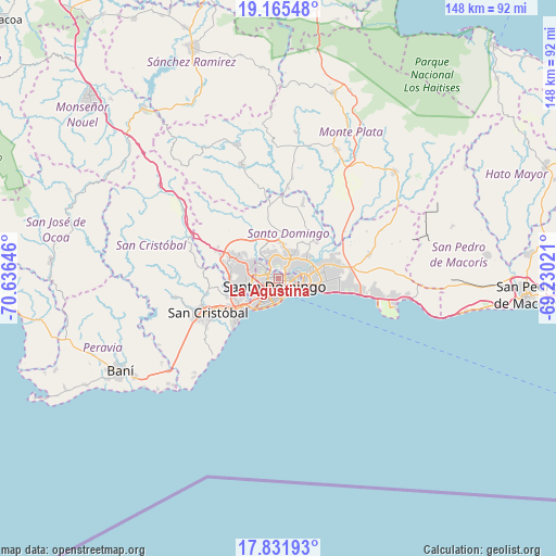
La Agustina GPS coordinates[2]
18° 30' 0" North, 69° 55' 59.988" West
| Map corner | latitude | longitude |
|---|---|---|
| Upper-left | 19.16548°, | -70.63646° |
| Center: | 18.5°, | -69.93333° |
| Lower-right: | 17.83193°, | -69.23021° |
| Map W x H: | 148.3×148.3 km | = 92.1×92.1mi |
| max Lat: | 19.89131° ⇑73% North |
| La Agustina: | 18.5° |
| min Lat: | ⇓27% South 17.80136° |
| min Long | La Agustina | max Long |
| -71.85022° | -69.93333° | -68.40431° |
| W 78.2%⇐ | ⇒21.8% E |
Elevation
Elevation of La Agustina is 31 m = 102 ft, and this is 135.3 m = 444 ft below average elevation for this country.
| Max E: |
1242 m = 4075 ft | 73.9% |
| Avg. | 166.3 m = 546 ft | |
| La Agustina | 31 m = 102 ft | |
Min E: |
5 m = 16 ft | 26.1% |
See also: Dominican Republic elevation on elevation.city.
Geographical zone
La Agustina is located in North Torrid zone (between Equator and Tropic of Cancer). Distance of this Northern Tropic circle is 548.9 km =341.1 mi to North.| Distance of | km | miles | from La Agustina |
|---|---|---|---|
| North Pole | 7950.1 | 4940 | to North |
| Arctic Circle | 5344.2 | 3320.7 | to North |
| Tropic Cancer | 548.9 | 341.1 | to North |
| Equator | 2057 | 1278.2 | to South |


Nearby cities:
15 places around La Agustina: (largest is in red/bold)
• Bajos de Haina
14.1 km =8.8 mi,  228°
228°
• Bella Vista
5.1 km =3.2 mi,  194°
194°
• Ciudad Nueva
5.6 km =3.5 mi,  131°
131°
• Cristo Rey
0 km =0 mi,  0°
0°
• El Carril
11.5 km =7.1 mi,  240°
240°
• Ensanche Luperón
3.5 km =2.2 mi,  90°
90°
• La Julia
3.7 km =2.3 mi,  180°
180°
• San Carlos
4 km =2.5 mi,  117°
117°
• San Cristóbal
19.9 km =12.4 mi, 242°
• San Gregorio de Nigua
20.5 km =12.7 mi, 230°
• Santo Domingo
5.3 km =3.3 mi, 125°
• Santo Domingo Este
8.1 km =5 mi,  99°
99°
• Santo Domingo Oeste
7 km =4.3 mi,  270°
270°
• Villa Consuelo
4 km =2.5 mi, 117°
• Villa Francisca
5 km =3.1 mi,  112°
112°
Sources, notices
• [Note1] Compared only with cities in Dominican Republic existing in our database
• [Src1] Map data: © OpenStreetMap contributors (CC-BY-SA)
• [Src2] Other city data from geonames.org with taken over terms of usage.
• [Src3] Geographical zone / Annual Mean Temperature by Robert A. Rohde @ Wikipedia
