Puerto Baquerizo Moreno geodata
Puerto Baquerizo Moreno (Galápagos) is a seat of a first-order administrative division; located in Ecuador in Pacific/Galapagos (GMT-6) time zone. With population of 4,214 people, there are 108 cities with bigger population in this country. Compared to other cities in Ecuador, 71.9% of cities are located further ↓South; 98.3% of cities are located further →East and 60.3% of cities have higher elevation than Puerto Baquerizo Moreno. Note1
Current local time in Puerto Baquerizo Moreno:
02:04 AM, TuesdayDifference from your time zone: hours


Puerto Baquerizo Moreno GPS coordinates[2]
0° 54' 6.192" South, 89° 36' 36.756" West
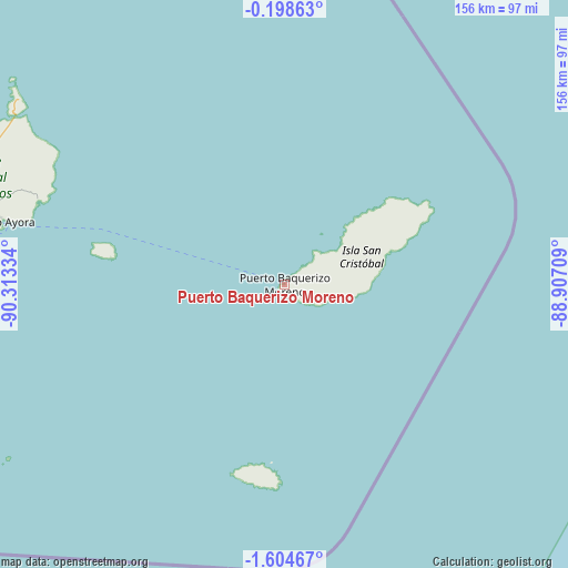
| Map corner | latitude | longitude |
|---|---|---|
| Upper-left | -0.19863°, | -90.31334° |
| Center: | -0.90172°, | -89.61021° |
| Lower-right: | -1.60467°, | -88.90709° |
| Map W x H: | 156.3×156.3 km | = 97.1×97.1mi |
| max Lat: | 1.35251° ⇑28.1% North |
| Puerto Baquerizo Moreno: | -0.90172° |
| min Lat: | ⇓71.9% South -4.38181° |
| min Long | Puerto Baqueriz | max Long |
| -90.96654° | -89.61021° | -76.89528° |
| W 1.7%⇐ | ⇒98.3% E |
Elevation
Elevation of Puerto Baquerizo Moreno is 54 m = 177 ft, and this is 891.1 m = 2924 ft below average elevation for this country.
| Max E: |
3131 m = 10272 ft | 60.3% |
| Avg. | 945.1 m = 3101 ft | |
| Puerto Baquerizo Moreno | 54 m = 177 ft | |
Min E: |
1 m = 3 ft | 39.7% |
See also: Ecuador elevation on elevation.city.
Geographical zone
Puerto Baquerizo Moreno is located in South Torrid zone (between Equator and Tropic of Capricorn). Distance of Equator is 100.3 km =62.3 mi to North.| Distance of | km | miles | from Puerto Baquerizo Moreno |
|---|---|---|---|
| Equator | 100.3 | 62.3 | to North |
| Tropic Capricorn | 2505.7 | 1557 | to South |
| Antarctic Circle | 7300.9 | 4536.6 | to South |
| South Pole | 9906.8 | 6155.8 | to South |


Nearby cities:
2 places around Puerto Baquerizo Moreno: (largest is in red/bold)
• Puerto Ayora
80.3 km =49.9 mi,  282°
282°
• Puerto Villamil
150.9 km =93.8 mi,  267°
267°
Sources, notices
• [Note1] Compared only with cities in Ecuador existing in our database
• [Src1] Map data: © OpenStreetMap contributors (CC-BY-SA)
• [Src2] Other city data from geonames.org with taken over terms of usage.
• [Src3] Geographical zone / Annual Mean Temperature by Robert A. Rohde @ Wikipedia
