Sant Just Desvern geodata
Sant Just Desvern (Catalonia) is a seat of a third-order administrative division; located in Spain in Europe/Madrid (GMT+2) time zone. With population of 15,811 people, there are 595 cities with bigger population in this country. Compared to other cities in Spain, 57.3% of cities are located further ↓South; 93.7% of cities are located further ←West and 88.3% of cities have higher elevation than Sant Just Desvern. Note1
Administrative division(s):
- Level 1: Catalonia
- Level 2: Província de Barcelona
- Level 3: Sant Just Desvern


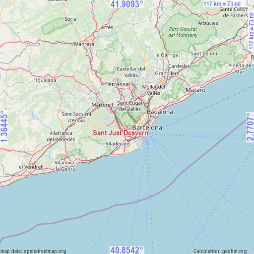
Sant Just Desvern GPS coordinates[2]
41° 23' 2.004" North, 2° 4' 3.288" East
| Map corner | latitude | longitude |
|---|---|---|
| Upper-left | 41.9093°, | 1.36445° |
| Center: | 41.38389°, | 2.06758° |
| Lower-right: | 40.8542°, | 2.7707° |
| Map W x H: | 117.3×117.3 km | = 72.9×72.9mi |
| max Lat: | 43.74134° ⇑42.7% North |
| Sant Just Desvern: | 41.38389° |
| min Lat: | ⇓57.3% South 27.64134° |
| min Long | Sant Just Desve | max Long |
| -18.00367° | 2.06758° | 4.2899° |
| W 93.7%⇐ | ⇒6.3% E |
Elevation
Elevation of Sant Just Desvern is 91 m = 299 ft, and this is 507 m = 1663 ft below average elevation for this country.
| Max E: |
1682 m = 5518 ft | 88.3% |
| Avg. | 598 m = 1962 ft | |
| Sant Just Desvern | 91 m = 299 ft | |
Min E: |
0 m = 0 ft | 11.7% |
See also: Spain elevation on elevation.city.
Geographical zone
Sant Just Desvern is located in North temperate zone (between Tropic of Cancer and the Arctic Circle). Distance of this Northern Tropic circle is 1995.5 km =1239.9 mi to South.| Distance of | km | miles | from Sant Just Desvern |
|---|---|---|---|
| North Pole | 5405.6 | 3358.9 | to North |
| Arctic Circle | 2799.7 | 1739.7 | to North |
| Tropic Cancer | 1995.5 | 1239.9 | to South |
| Equator | 4601.5 | 2859.2 | to South |


Nearby cities:
15 places around Sant Just Desvern: (largest is in red/bold)
• Cornellà de Llobregat
4 km =2.5 mi,  160°
160°
• Esplugues de Llobregat
1.9 km =1.2 mi,  113°
113°
• L'Hospitalet de Llobregat
3.8 km =2.4 mi,  134°
134°
• Las Tres Torres
5.4 km =3.4 mi,  70°
70°
• Les Corts
5.2 km =3.2 mi,  86°
86°
• Pedralbes
3.6 km =2.2 mi,  78°
78°
• Sant Boi de Llobregat
5.2 km =3.2 mi,  209°
209°
• Sant Feliu de Llobregat
1.5 km =0.9 mi,  267°
267°
• Sant Joan Despí
2 km =1.2 mi,  204°
204°
• Sant Vicenç dels Horts
5.2 km =3.2 mi,  281°
281°
• Santa Coloma de Cervelló
4.8 km =3 mi,  247°
247°
• Sants - Badal
5.1 km =3.2 mi,  101°
101°
• Sarrià
4.6 km =2.9 mi,  62°
62°
• Vallvidrera, el Tibidabo i les Planes
4.4 km =2.7 mi,  24°
24°
• la Maternitat i Sant Ramon
4.2 km =2.6 mi, 94°
Sources, notices
• [Note1] Compared only with cities in Spain existing in our database
• [Src1] Map data: © OpenStreetMap contributors (CC-BY-SA)
• [Src2] Other city data from geonames.org with taken over terms of usage.
• [Src3] Geographical zone / Annual Mean Temperature by Robert A. Rohde @ Wikipedia
